
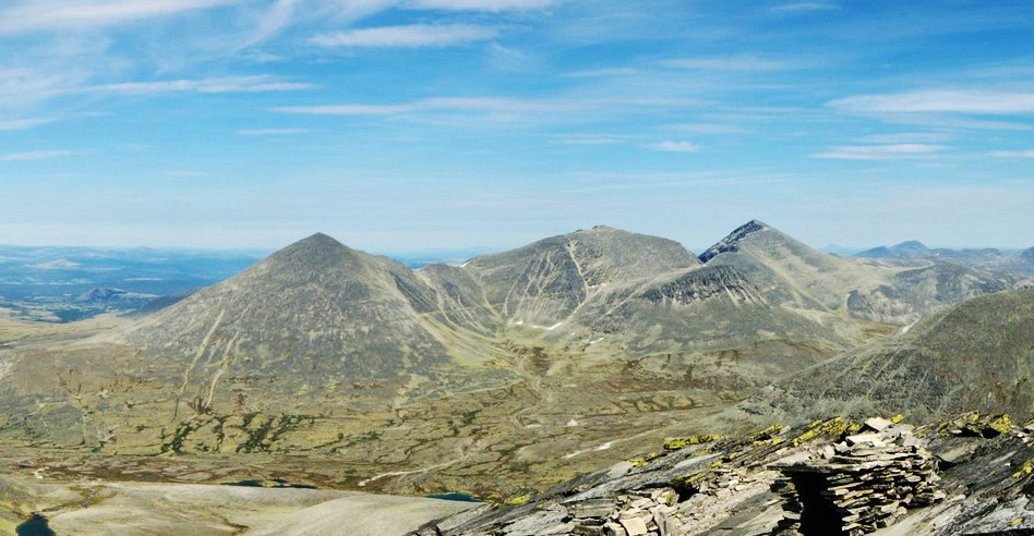
SummitClimbs Field Note: Høgronden is not a peak for the casual day out. At 2,114 metres, it is the highest summit in the Rondane range, and the route demands solid fitness, competent navigation, and a calm head for loose terrain. The reward is one of Norway’s most complete alpine panoramas, with a quiet summit that sees less traffic than its more famous neighbour, Rondeslottet. This is a mountain for hikers who value solitude and are comfortable making their own route on the upper slopes.
Why This Place Belongs on a Norway Mountain Plan
Rondane National Park is one of Norway’s oldest protected areas, and Høgronden sits at its northeastern edge as the undisputed high point. Unlike the more commercialised peaks of the Alps, this landscape retains a raw, ancient character. The summit is a broad, rounded dome shaped by glacial ice, surrounded by sharp arêtes and U-shaped valleys that cut deep into the massif. From the top, you trace the entire arc of the Rondane skyline — Midtronden, Digerronden, Rondeslottet, Vinjeronden — all within a single sweeping view.
This is a peak that suits the experienced mountain hiker who wants to move beyond marked trails and into genuine route-finding terrain. It also rewards those willing to combine it with a ridge traverse to Digerronden, one of the classic high-altitude walks in the region. For anyone building a serious Norway hiking itinerary, Høgronden offers a benchmark of both physical challenge and alpine atmosphere.
The SummitClimbs Snapshot
- Location: Folldal Municipality, Innlandet county, within Rondane National Park
- Height: 2,114 metres (6,936 feet)
- Access: Norwegian County Road 27 provides the most direct approach from the east; nearest settlement is Folldal to the north
- Season: Late June to September for best conditions; snow patches linger on northern faces even in midsummer
- Duration: 6–8 hours round trip, depending on pace and conditions
- Elevation gain: 800–900 metres from typical trailheads
- Difficulty: Demanding; requires scrambling over loose rock and competent route-finding on the summit cone
- Suits: Experienced hikers comfortable with exposed terrain and navigation without a marked trail
Route Reality and Local Conditions
The most practical approach starts from trailheads along County Road 27, which runs east of the mountain and connects the Gudbrandsdalen valley with the high plateau. Parking is available at designated spots, and seasonal bus services run along the road during summer, connecting to rail at Otta or Dombås. From the trailhead, well-marked paths lead west into the park, crossing open birch forest and heathland before the gradient steepens and vegetation thins to bare stone and scree.
The final ascent is where the character of the route changes. There is no marked trail to the summit. You navigate over loose rock and boulder fields, picking your own line toward the broad top. This is not a place to rely on a GPS alone — a detailed map and compass are essential, and the ability to read terrain is more valuable than any app. The summit itself is a rounded, exposed dome where the wind can be fierce even on calm days below.
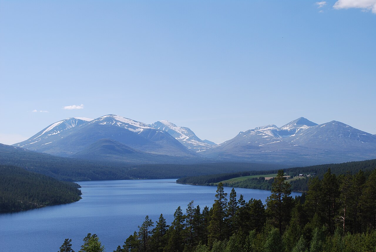
Many hikers treat Høgronden as part of a longer day, linking it with Digerronden via the connecting ridge. That traverse is a genuine high-altitude walk with exposure and requires a steady head for heights. If conditions are good and you have the energy, it is one of the finest ridge walks in the park. If weather is marginal, treat the ridge with respect — retreat is always the better option.
Accommodation in the area includes DNT cabins at Rondvassbu and Bjørnhollia, which serve as excellent bases for multi-day exploration. Book ahead in peak summer; these cabins are popular and spaces fill quickly.
What to Watch For
- Weather volatility: Conditions in Rondane change rapidly. Clear skies can turn to rain, wind, or fog within 30 minutes. Always carry waterproof and windproof layers, even on a forecast that looks perfect.
- Route-finding on the summit cone: The upper slopes have no marked path. Study the terrain from below, pick a line, and check your bearing before you commit. Cairns may be present but are not reliable.
- Loose rock: The final ascent is over scree and unstable boulders. Boots with aggressive soles and good ankle support are mandatory. Test each step; a misplaced foot can mean a fall.
- Limited water: There are no reliable water sources on the upper mountain. Carry at least 1.5 litres per person, plus a filter or purification method if you plan to refill from streams lower down.
- Mobile coverage: Expect little to no signal once you leave the valley floor. A headlamp, first-aid kit, and emergency shelter are non-negotiable.
- Leave No Trace: This is a protected national park. Pack out everything you bring, including toilet paper and food scraps. The alpine environment is fragile and slow to recover.
The SummitClimbs Take
Høgronden is not the easiest peak in Rondane, nor the most photographed. It does not have the dramatic pyramid profile of Rondeslottet, and it does not see the same crowds. What it offers is something quieter and, for many hikers, more valuable: a genuine high-mountain experience that requires you to engage with the terrain rather than follow a line of other walkers. The summit is a place where you can stand alone, turn a full circle, and see the entire range laid out beneath you.
This is a mountain for the person who has done a few serious hikes and wants to step up — who is ready to navigate without a marked trail, to scramble over loose rock, and to make decisions based on weather and conditions rather than a guidebook schedule. If that sounds like you, then Høgronden belongs on your list. If you are newer to mountain hiking, consider building experience on lower, more defined routes in the park before committing to this one.
Either way, the Rondane massif rewards those who come prepared. And from its highest point, the reward is as complete as it gets in Norwegian alpine terrain.
Keep the Trails Alive
Summit Climbs is free — no ads, no paywalls, no sponsored fluff.
Every guide is written from real experience to help your next adventure.
If it helped, a small support means the world and keeps the site running.