
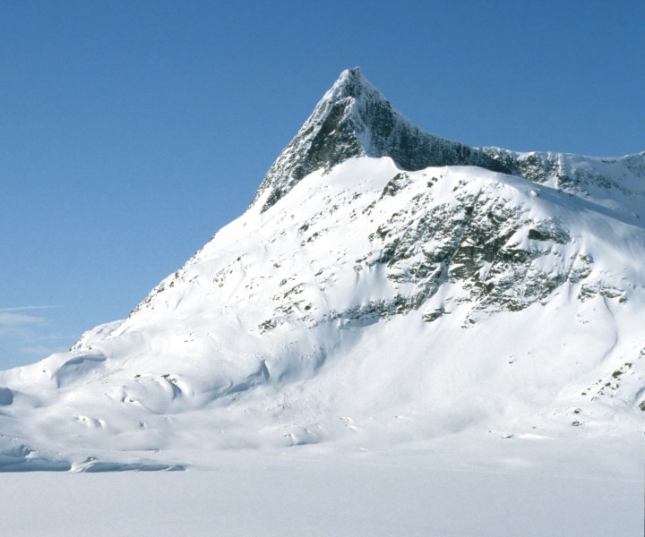
SummitClimbs Field Note: Falketind, known locally as the Eagle Peak of Jotunheimen, is not a mountain for casual sightseers. It’s a serious, full-day undertaking that rewards those who come prepared with a deep sense of history and a sweeping view over one of Norway’s most dramatic landscapes. Located in Årdal Municipality, Vestland county, within the Utladalen Landscape Protection Area, this peak sits roughly 7 kilometres east of the historic mountain farm Vettismorki and 7.5 kilometres northwest of Lake Tyin. The approach is as much a part of the experience as the summit, and conditions here demand respect.
Why This Place Belongs on a Norway Mountain Plan
Falketind holds a unique place in Norwegian mountaineering. In 1820, a party including geologist Baltazar Mathias Keilhau and naturalist Christian Peder Bianco Boeck completed what is widely considered the first known ascent of an alpine mountain in Norway. They approached via the glacier now known as Falkbreen and the northern ridge. At the time, the peak was called Koldedalstinden. Over fifty years later, poet Aasmund Olavsson Vinje renamed it Falketind—Eagle Peak—inspired by its sharp, raptor-like silhouette. That expedition is often celebrated as the “discovery of Jotunheimen,” marking the start of modern alpine exploration in the region.
What sets Falketind apart from other peaks in Jotunheimen is this blend of accessible wilderness and historical weight. The mountain sits inside a protected landscape, which keeps development minimal and the sense of remoteness intact. Its triangular summit ridge is one of the most recognisable in the range. From the top, you look out over Lake Tyin, the deep cleft of Utladalen, and an endless stretch of Norwegian mountains. For anyone building a serious hiking itinerary in Northern Europe, this is a classic that combines physical effort with a tangible connection to the land’s cultural past.
The SummitClimbs Snapshot
- Location: Årdal Municipality, Vestland county, within Utladalen Landscape Protection Area
- Nearest settlements: Vettismorki (east), Lake Tyin area (northwest), Årdal town
- Classic route: Northern ridge via Falkbreen glacier tongue
- Round-trip time: 8 to 10 hours, full day
- Best season: Late June to early September
- Essential gear: Sturdy boots, map and compass, rain gear, warm layers, glacier equipment (crampons and ice axe recommended)
- Who it suits: Experienced hikers comfortable with steep, sustained climbing and exposed scrambling on rock and snow
Route Reality and Local Conditions
The classic route follows the historical line up the northern ridge, starting from near Vettismorki or from the Tyin side. The trail begins gently through birch forest and alpine meadows before steepening as you approach the glacier tongue of Falkbreen. Crossing the snowfield requires caution, especially in late season when crevasses may open. The final ridge scramble is exposed but well-marked with cairns. Most hikers take 8 to 10 hours round trip.
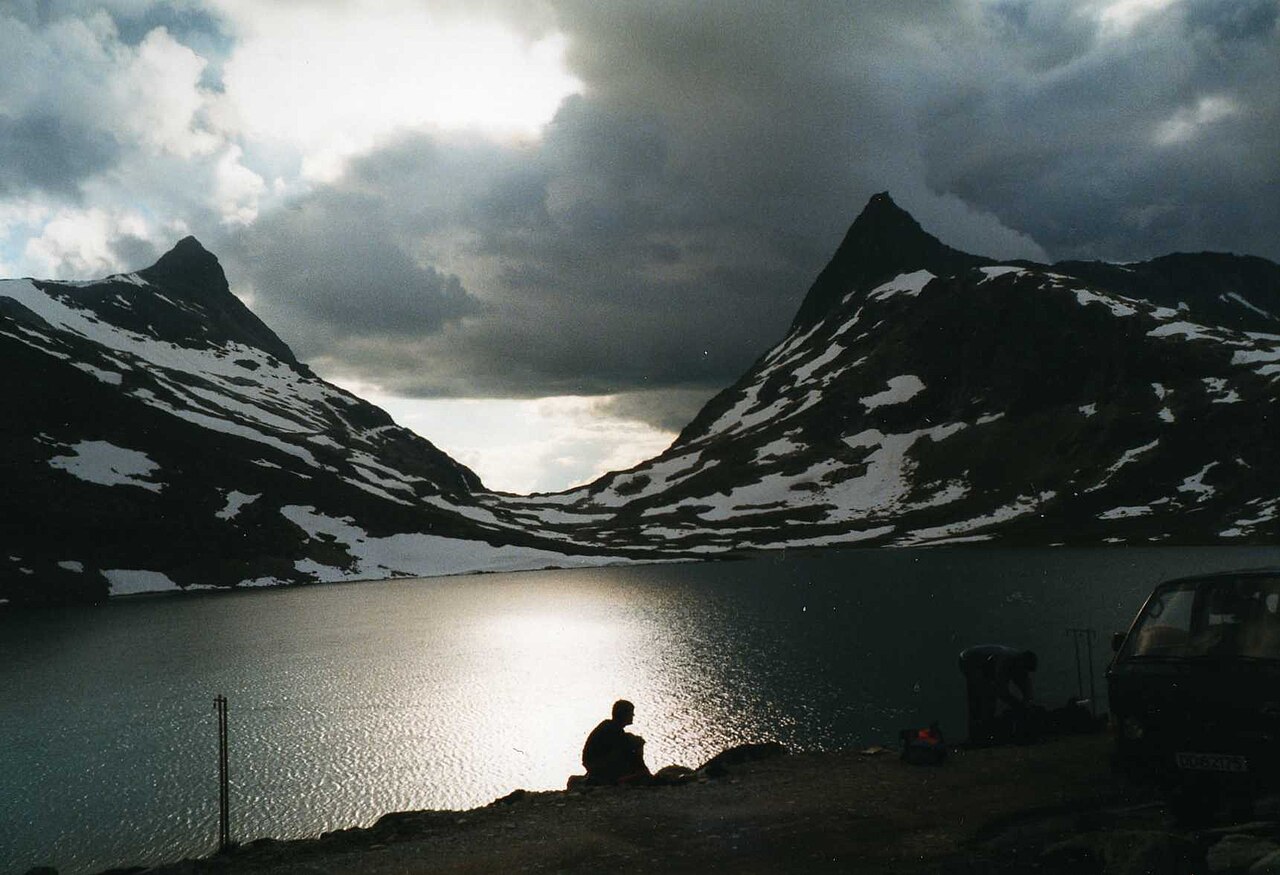
Conditions change fast here. Snowfields can linger into July, making route-finding trickier. The glacier is most stable from late July through August. Always check the latest conditions with the Norwegian Trekking Association (DNT) or local guides before setting out. Bring a detailed map from the Turkart Jotunheimen series and a compass—GPS can be unreliable in these valleys. Water is plentiful from streams, but treat or boil it, or bring a filter.
What to Watch For
Access and Transport
Reaching Falketind requires planning. The primary access points are Vettismorki (east of the peak, a common trailhead from the west), the northwest shore of Lake Tyin (with parking near the E16 highway), and Årdal town (the nearest settlement with accommodation, supplies, and bus connections). From Oslo, drive via the E16 towards Fagernes, then continue towards Tyin. Alternatively, take a bus from Oslo or Bergen to Årdal and arrange local transport. The journey itself winds through valleys and alongside fjords—part of the experience, but add time accordingly.
Glacier Safety
Falkbreen is a remnant of the Pleistocene ice sheets that sculpted this landscape. Crossing it is part of the classic route, but it’s not a walk in the park. Crampons and an ice axe are recommended, especially in early summer. In late season, crevasses may open. If you’re not experienced on snow and ice, consider hiring a local guide or skipping the glacier crossing altogether—there are alternative approaches that avoid it.
Weather and Timing
The optimal season is late June to early September, when snow cover on the ridge is minimal and the glacier is most stable. July and August offer the longest daylight hours, perfect for a long day hike. Autumn brings stunning colours but shorter days and more unpredictable weather. Always carry rain gear, warm layers, and extra food. Conditions can shift from clear to stormy in under an hour.
Leave No Trace
Falketind lies within the Utladalen Landscape Protection Area. Pack out all rubbish, avoid disturbing wildlife, and camp only in designated areas. The alpine vegetation is fragile and slow to recover, so stick to established trails. This is not a place for shortcuts or casual camping.
The SummitClimbs Take
Falketind is not a mountain you tick off a list. It’s a journey into the heart of Norwegian mountain heritage. The history is real—this is where modern alpine exploration in Norway began. The geology is ancient, with gneisses and granites over a billion years old, thrust upward during the Caledonian orogeny and later carved by ice. The glacier still clings to the northern flank, a living reminder of that icy past.
Standing on the summit, with the wind in your face and the vast Jotunheimen spread below, you understand why this peak captured the imagination of Norway’s earliest mountaineers. It rewards preparation, respect, and effort. If you’re a seasoned hiker looking for a classic challenge that connects you to both the landscape and the history of Northern Europe outdoor adventures, put Falketind on your plan. Lace up your boots, check the conditions, and go with a clear head and a full pack.
Keep the Trails Alive
Summit Climbs is free — no ads, no paywalls, no sponsored fluff.
Every guide is written from real experience to help your next adventure.
If it helped, a small support means the world and keeps the site running.