
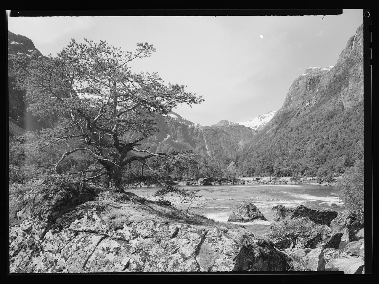
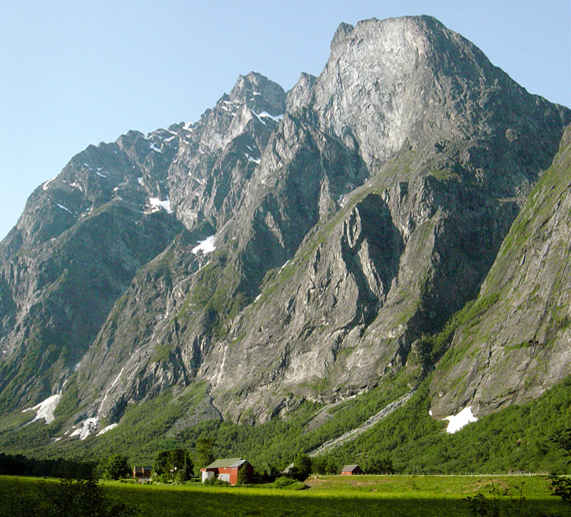
SummitClimbs Field Note: Romsdalen runs 60 kilometres from the Romsdalsfjorden inland through Rauma Municipality, then into Lesja. The E136 follows it the whole way. The Rauma river gives the valley its name—Old Norse Raumsdalr—and its colour. This is not a valley you drive through on the way to something else. It is the destination. Kongen, “The King,” sits above it all, visible from the highway, and it demands a decision: are you here to look, or to climb?
Why This Place Belongs on a Norway Mountain Plan
Most Norwegian valleys offer drama. Romsdalen offers instability—in the best sense. The cliffs are actively falling. The Mannen rock formation, a massive unstable slope above the valley, is monitored year-round by geologists. When it eventually slides—and it will—it may dam the Rauma and cause a catastrophic flood downstream. That is not a hypothetical. It is the living geology that makes this valley different.
The surrounding alpine summits, including the Trolltindene range, sit within Reinheimen National Park. Kongen itself is not the highest peak here, but its profile from the valley floor is unmistakable. It functions as a landmark, a reference point, and a legitimate objective for hikers who want something more than a viewpoint stroll. The contrast is what stays with you: the green valley floor, the grey rock, the silver river, and the sense that none of it is permanent.
The SummitClimbs Snapshot
- Region: Møre og Romsdal, traditional Romsdal district
- Nearest town: Åndalsnes (trailheads accessible from E136)
- Park access: Reinheimen National Park
- Terrain: Steep ascents, boulder fields, loose scree, exposed ridges
- Season: Late June to September, weather-dependent
- Skill level: Strenuous; requires experience with rocky, exposed terrain
- Navigation: Marked trails, but not reliable in poor visibility; map and compass essential
- SummitClimbs verdict: A serious day in serious mountains, not a tourist detour
Route Reality and Local Conditions
Approaching Kongen means starting from the valley floor near Åndalsnes or one of the smaller trailheads along the E136. Parking is limited. In July and August, arrive early or accept a longer walk-in. The Rauma railway follows the valley and offers an alternative access point, but timetables are sparse and you will still need to cover ground on foot.
The climb itself moves through birch forest, then into boulder fields left by retreating glaciers. Above treeline, the route opens onto rocky slopes and, eventually, exposed ridges. The footing changes constantly: solid rock one step, loose scree the next. Poles help, but they are no substitute for careful foot placement. The ascent takes several hours, and the elevation gain is significant. This is not a route for a casual afternoon.
From the upper slopes, the view is the payoff. The entire valley unfolds below. The Rauma river snakes through the floor. To the west, the Trolltindene peaks rise in sharp spires. To the east, the valley widens toward Lesja. On a clear day, the silence is broken only by wind and the distant sound of waterfalls. That moment—standing on the King, looking down a valley that is still being carved—is why you came.
What to Watch For
Weather is not optional
Sunshine to snow in two hours. It happens. Even in July, carry waterproof and windproof layers, warm insulation, hat, and gloves. A thermos with a hot drink is not luxury; it is survival gear on a cold summit.
Navigation is your responsibility
Trails exist but are not always obvious in mist or cloud. Mobile coverage is unreliable. Carry a detailed map and a compass, and know how to use them. A GPS device or offline map is a wise backup, not a primary system.
Footwear is non-negotiable
Sturdy, broken-in boots with aggressive tread and ankle support. The boulder fields and scree demand reliable traction. Approach shoes will not cut it.
The Mannen formation is off-limits
Do not attempt to climb or approach it. Warning signs exist for a reason. This is an active geological hazard, not a photo opportunity.
Inform someone of your route
Tell someone where you are going and when you expect to return. Standard practice for any serious mountain day, and non-negotiable here.
The SummitClimbs Take
Kongen is not a beginner summit. It is not a place to test new gear or learn basic navigation. It is a route for people who have already done their homework on Norwegian mountain travel and want something that rewards preparation with perspective.
Romsdalen itself is worth the journey. The geological story is visible in every boulder and cliff. The Rauma river keeps carving. The mountains keep shifting. And Kongen sits above it all, patient and indifferent to whether you make the summit. That is the kind of place SummitClimbs sends people to—not because it is easy, but because it is real.
Plan your approach. Respect the conditions. And when you stand on that ridge, looking down the valley, you will understand why the Norse named this land with such reverence.
Keep the Trails Alive
Summit Climbs is free — no ads, no paywalls, no sponsored fluff.
Every guide is written from real experience to help your next adventure.
If it helped, a small support means the world and keeps the site running.