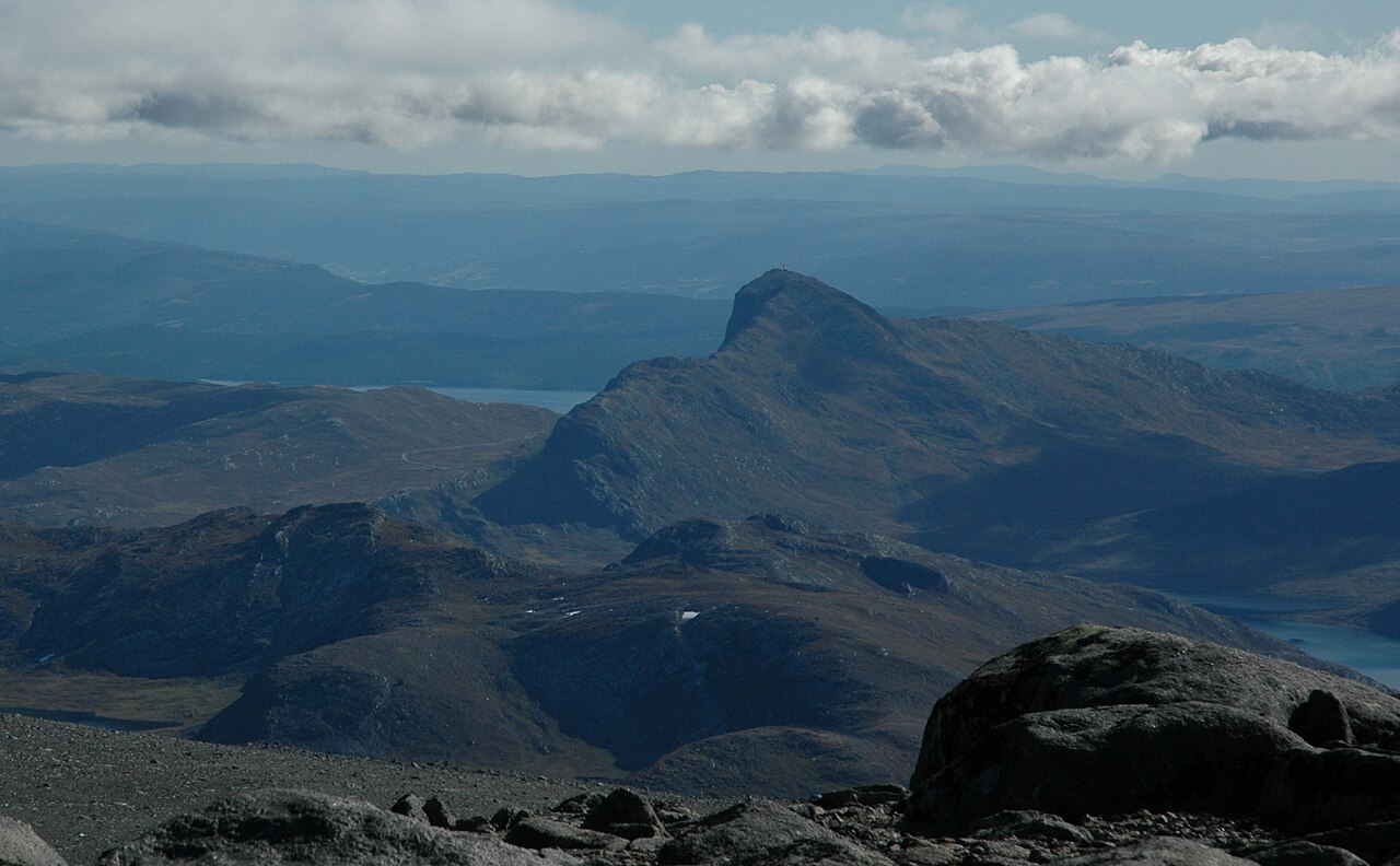
SummitClimbs Field Note: Bitihorn is one of those rare peaks that delivers a genuine alpine summit without demanding an expedition. Sitting at 1,608 metres on the border between Vang and Øystre Slidre municipalities in Innlandet county, this pyramidal horn of Precambrian rock is visible from County Road 51, just 7 kilometres northwest of Beitostølen. It’s a practical, half-day outing that suits hikers who want Jotunheimen views without committing to a full day of technical terrain. The route is straightforward, the access is simple, and the payoff is a 360-degree panorama over some of Norway’s most dramatic mountain architecture.
Why This Place Belongs on a Norway Mountain Plan
Bitihorn occupies a sweet spot in the Jotunheimen range. It’s not a training peak for mountaineers, nor is it a roadside viewpoint. It’s a genuine summit—rocky, exposed in sections, and requiring steady effort—but one that a fit walker can reach in under two hours from the car. That accessibility makes it a practical choice for a range of scenarios: a warm-up for longer treks, a family objective with older children, or a quick summit fix when weather windows are narrow. Its position on the west side of County Road 51 means you can pull over, hike, and be back at the car in time for a late lunch. For anyone building a Jotunheimen itinerary, Bitihorn fills the role of an introductory alpine day without the logistics of a full traverse or overnight stay.
The SummitClimbs Snapshot
- Location: Border of Vang and Øystre Slidre municipalities, Innlandet county, Norway. Trailhead off County Road 51, about 7 km northwest of Beitostølen.
- Elevation: 1,608 metres (5,276 feet). Elevation gain from the trailhead is roughly 500–600 metres.
- Time required: 2–3 hours round trip for most hikers. Allow extra for summit time and photo stops.
- Difficulty: Moderate. Steady ascent on a well-trodden path with some easy scrambling near the top. No technical climbing required.
- Best season: Late June to September, when snow has cleared from the upper slopes. Shoulder seasons can involve snow patches and slippery rock.
- Who it suits: Hikers with moderate fitness who are comfortable on rocky terrain. Families with experienced children. Solo walkers seeking a manageable objective. Not suitable for those with limited mobility or a fear of exposed sections.
- Navigation: The route is marked with cairns and is clear in good visibility. In mist or cloud, a map and compass or GPS are essential. Fog can descend rapidly.
- Facilities: None at the trailhead. Nearest services are in Beitostølen, 7 km southeast.
Route Reality and Local Conditions
The trail begins with a gentle gradient through birch forest and heather, then steepens as it breaks above treeline onto open, rocky slopes. The path is well-worn and easy to follow in clear weather, with cairns marking the way through the upper section. The final push involves a short section of boulder scrambling—nothing that requires hands-on climbing, but it demands careful foot placement and steady balance. The summit itself is a rocky cairn with a broad view that takes in Rasletinden, the Raslet glacier, Gråhøi, Kvernhøi, and Skaget. On a clear day, the Jotunheimen massif stretches to the north, and the valleys around Beitostølen lie green and calm below.
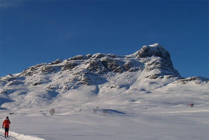
Conditions change fast here. A sunny morning can turn to wind and rain within an hour, and fog can reduce visibility to a few metres. The rock can be slick after rain, especially on the upper boulder field. In early summer, snow patches may linger on the north-facing slopes, requiring careful route-finding. Later in the season, the trail is dry and straightforward, but the wind at the summit can be strong even on calm days. Pack a waterproof layer and a warm mid-layer regardless of the forecast.
Parking is limited to a small area on the west side of County Road 51, directly opposite the mountain. Arrive early in peak season (July–August) to secure a spot. There are no facilities at the trailhead, so fill water bottles and use toilets in Beitostølen before driving up. Seasonal bus services run along Road 51 from Beitostølen, but check timetables in advance as services are limited.
What to Watch For
- Weather shifts: Jotunheimen weather is notorious for rapid changes. Check the forecast at yr.no before setting out, and be prepared to turn back if conditions deteriorate. Fog is the most common hazard—once you lose visibility, the cairns can be hard to spot.
- Rock stability: The upper section is composed of loose boulders and scree. Test each step, especially on the descent. Wet rock is significantly more slippery.
- Exposure: The final ridge is narrow in places. There is no sheer drop, but a slip could result in a tumble over rocky terrain. Hikers with a strong fear of heights may find this section uncomfortable.
- Sun and wind: At altitude, UV exposure is high even on overcast days. Sunscreen, sunglasses, and a hat are essential. The wind at the summit can be strong enough to affect balance—keep a low centre of gravity when moving around the cairn.
- Water: No streams on the upper mountain. Carry at least 1 litre per person for the round trip. More on hot days.
- Leave no trace: The alpine ecosystem is fragile. Pack out all rubbish, including food scraps. Avoid disturbing wildlife—reindeer and ptarmigan are sometimes seen on the slopes.
The SummitClimbs Take
Bitihorn is a solid, practical choice for anyone wanting a genuine summit in Jotunheimen without the overhead of a full-day expedition. It’s not a wilderness experience—you can hear the road from the lower slopes, and the trail is busy in summer—but the views from the top are as good as many peaks that require twice the effort. For a first alpine hike in Norway, or a quick objective on a road trip through Innlandet, it delivers exactly what it promises: a straightforward ascent, a rocky summit, and a panorama that stretches across one of Europe’s most dramatic mountain ranges. Treat it with respect—check the weather, carry the right gear, and know when to turn back—and you’ll come away with a clear sense of what makes this corner of Norway worth the journey.
Keep the Trails Alive
Summit Climbs is free — no ads, no paywalls, no sponsored fluff.
Every guide is written from real experience to help your next adventure.
If it helped, a small support means the world and keeps the site running.