
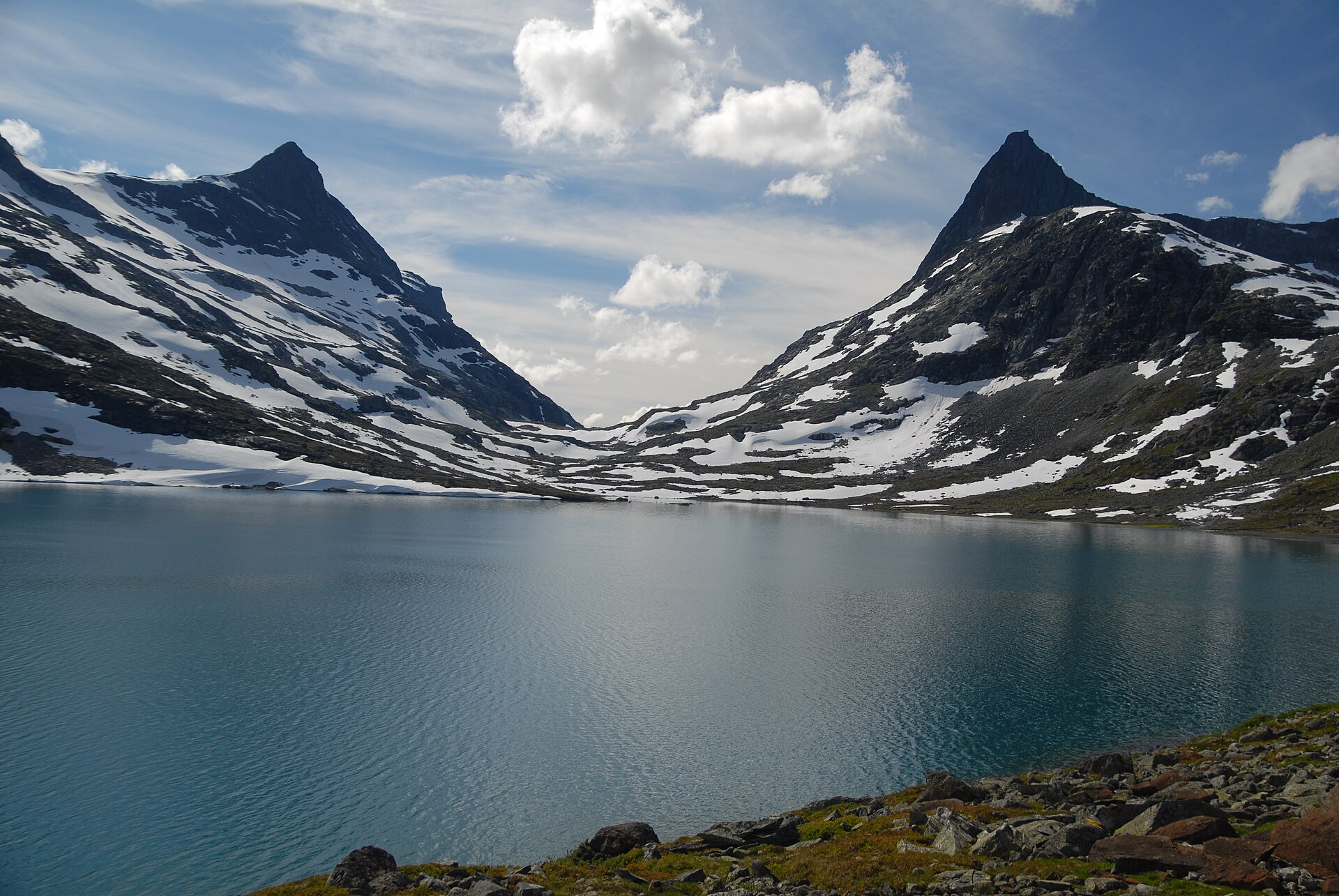
SummitClimbs Field Note: Falketind (“falcon peak”, 2,067 m by ut.no’s figure; Norwegian Wikipedia gives 2,061 m) is the sharp summit in southwestern Jotunheimen, in Årdal, Vestland, inside the Utladalen Landscape Protection Area. Its first ascent in 1820 was the first ascent of a mountain of “alpine character” in Norway. Both routes in use today start in Koldedalen, cross a glacier and end with scrambling or easy climbing. Ut.no strongly recommends a guide with crampons and rope; guided trips run from Tyinholmen and Fondsbu from about 15 July to 1 October.
The Discovery of Jotunheimen
On 14 July 1820, the botanist Christian Peder Bianco Boeck, the geologist Baltazar Mathias Keilhau and the reindeer herder Ole Urdi reached the summit via the glacier Snøggeken (Falkbreen) and the north ridge. At that time the mountain was called Koldedalstinden; more than fifty years later the poet Aasmund Olavsson Vinje gave it the name Falketind. Looking back, the expedition, which had started in Øystre Slidre, came to be known as “the discovery of Jotunheimen”. The name Koldedalstinden now belongs to another mountain on the opposite side of Koldedalen.
The name is simple: falk means “falcon” and tind means “peak”. Falketind lies about 7 km east of the old mountain farm Vettismorki and about 7.5 km northwest of the lake Tyin.
Falketind at a Glance
- Height: 2,067 m (ut.no); 2,061 m (Norwegian Wikipedia)
- Location: Årdal, Vestland; Utladalen Landscape Protection Area, southwestern Jotunheimen
- First ascent: Boeck, Keilhau and Ole Urdi, 14 July 1820
- Normal route: 13.5 km and 1,071 m of ascent there and back; 10–12 hours from Koldedalen; June–October
- Pioneer route: 7.2 km and 881 m of ascent there and back; 1–2 hours shorter but a little harder; July–October
- Gear: crampons and rope; ut.no strongly recommends a guide
- Guiding: Tyinholmen and Fondsbu, about 15 July to 1 October
The Normal Route (Normalveien)
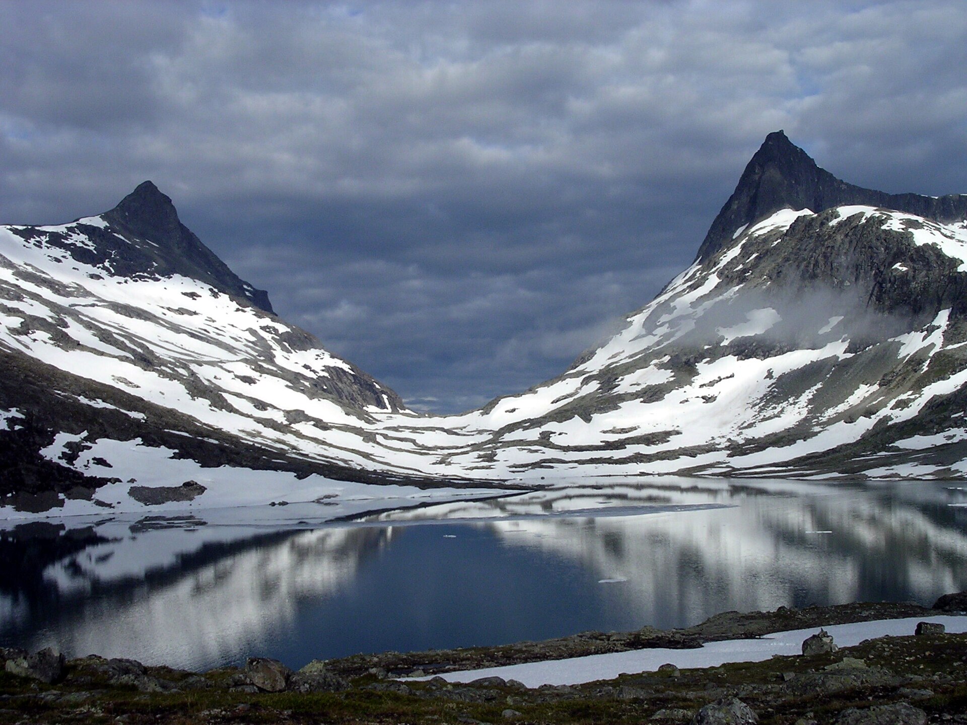
Drive from Tyinholmen along Koldedølsvegen to the barrier about 8 km into Koldedalen. The route starts at the end of the construction road into Morka-Koldedalen, between Hjelledalstinden and Falketind. Follow the north shore of lake 1291; near the end you pass a steep and sometimes awkward snowfield early in the season. A fairly clear path then leads on to Andrevatnet, where rockfall is a risk, especially early in the season. Along the north end of Andrevatnet there is coarse scree in places, but the line is clear.
Cross the river coming down from Stølsnosbreen and follow its left side up a fairly steep slope with exposed sections of slabs and loose stone. The lower part of the glacier is an isolated remnant, so keep to its edge before moving onto the main glacier, if you are equipped for glacier travel; the alternative is the loose moraine to the right, which is unstable ground. At the top of the glacier you reach solid rock at the foot of the main summit, towards the east face. Follow the ridge to the top; the last part is steep with some scrambling. Ut.no warns that there are crevasses in the upper part of the glacier.
The Pioneer Route (Pionerruta)
The guided trips from Tyinholmen and Fondsbu today follow the same line as the first ascent party in 1820. It starts straight up from Koldedalshytta at the end of the road in Koldedalen and goes onto Snøggeken (Falkbreen), where crampons and rope are used. Aim just right of the lowest point on the ridge between Falketind and Østre Stølsnostind, where the snow reaches highest. The climb up the wall is grade 2/3 scrambling and climbing, and a safety rope must be used; after the first steep section, a natural line of ledges leads up. At the top of the wall there is usually a cornice to cross, normally without big problems, and then the north ridge leads to the summit.
Before You Go
- Book a guide: contact Tyinholmen or Fondsbu for guided ascents in season.
- Glacier gear: crampons, rope and glacier skills are required on both routes.
- Early season: watch for steep snowfields and rockfall on the normal route.
- Weather: check the mountain forecast on yr.no before you go.
The SummitClimbs Take
Falketind is where Norwegian mountaineering began: a glacier, a steep wall and a sharp ridge, first climbed in 1820. Follow the pioneers’ line with a guide from Tyinholmen or Fondsbu, or take the longer normal route if your party has full glacier skills. For more peaks nearby, see our Jotunheimen guide.
Facts from ut.no (Normalveien til Falketind), ut.no (Pionerruta til Falketind), Norwegian Wikipedia (Falketind) and Wikipedia. Always check current conditions before you go.
Keep the Trails Alive
Summit Climbs is free — no ads, no paywalls, no sponsored fluff.
Every guide is written from real experience to help your next adventure.
If it helped, a small support means the world and keeps the site running.