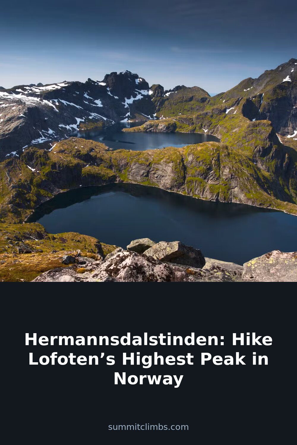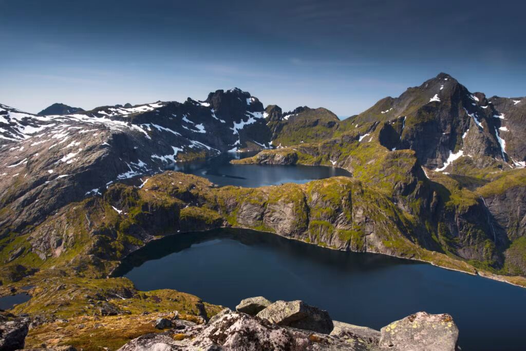
SummitClimbs Field Note: Hermannsdalstinden is the high point of the Lofoten archipelago, topping out at 1,029 metres on the island of Moskenesøya. This is not a casual day walk. It is a full-commitment mountain day that demands route judgment, weather discipline, and a willingness to move over terrain that does not forgive carelessness. If you are planning a Norway hiking trip and want something that feels earned, this is the route.
Why This Place Belongs on a Norway Mountain Plan
Lofoten’s reputation precedes itself. The postcard images of red fishing huts, turquoise water, and dramatic peaks are real. But most visitors stay low, photographing the fjords from the road or walking short coastal trails. Hermannsdalstinden is different. It pulls you away from the crowds and into the kind of terrain that made you want to come to Norway in the first place.
The mountain sits on Moskenesøya, the southernmost of the major Lofoten islands. From the summit, the view is unobstructed in every direction: the jagged spine of the Lofoten Wall to the east, the open Norwegian Sea to the west, and the Vesterålen islands faint on the northern horizon. It is a vantage point that few hikers reach, and that is exactly the point.
This is a route for people who understand that the best views are the ones you have to work for. If you want a short walk with a cafe at the end, stay in Reine. If you want to stand on top of the archipelago and feel the full force of the Arctic wind, this is your mountain.
The SummitClimbs Snapshot
- Location: Moskenesøya, Lofoten, Nordland county, Norway
- Height: 1,029 metres (3,376 feet)
- Starting point: Vindstad (via boat from Reine) or Kjerkfjorden (longer approach)
- Base camp: Munkebu Hut, a staffed cabin with food and accommodation
- Round-trip time from Munkebu: 6–8 hours, depending on conditions and your pace
- Technical difficulty: Moderate to challenging. Scrambling on exposed rock. Not for beginners.
- Best season: Late June to early September. Weather windows are narrow even in summer.
- Navigation: Marked trail, but map and compass essential. Visibility can drop to zero.
Route Reality and Local Conditions
The standard approach starts with a boat ride from Reine across the fjord to Vindstad. This is not optional unless you are prepared for a much longer walk from Kjerkfjorden. The boat is a local service, and timings are seasonal. Check ahead, and do not assume a late departure is possible.
From Vindstad, it is a two-to-three-hour hike to Munkebu Hut. The trail gains roughly 500 metres over 6 kilometres. It is a steady climb through a valley that holds water well into summer, so expect wet feet even on a dry day. The ground is a mix of grass, rock, and bog. Waterproof boots are not a suggestion.
Munkebu Hut is the logical place to spend the night before the summit push. It is a proper Norwegian Turistforening cabin: warm, well-maintained, and staffed in season. You can buy meals and drinks, but do not rely on this. Bring your own food and a sleeping bag liner at minimum. The hut fills up in July and August. Book ahead.
The summit route from Munkebu is where the real work begins. The first section is a straightforward climb on a defined trail. As you gain height, the path becomes rougher. Loose rock is common. The final 300 metres involve scrambling over exposed ridges. The rock is generally solid, but wet conditions make it slick. This is not a place for people who are uncomfortable with exposure.
The summit itself is a small, flat area with room for a handful of people. On a clear day, you will want to stay for an hour. On a bad day, you will want to take your photo and get down. The descent is harder on the knees than the ascent, and the loose rock demands careful foot placement all the way back to the hut.
What to Watch For
Weather is the main variable. Lofoten’s weather changes fast. A clear morning can turn into a whiteout by midday. The summit is often in cloud when the lower valleys are clear. If the forecast shows low cloud or high wind above 800 metres, postpone. There is no shame in turning around. The mountain will still be there tomorrow.
Visibility can disappear without warning. The trail is marked with cairns, but in fog, you can lose the line in minutes. Carry a map and compass, and know how to use them. A GPS is a backup, not a primary tool. Batteries die in cold weather, and phone reception is unreliable.
Water is plentiful on the approach but scarce on the upper mountain. Fill up at streams before you leave Munkebu. Carry at least two litres. A filter or purification tablets are useful for topping up from running water.
Footwear matters more than usual. The terrain is rough, and ankle support is not optional. Approach shoes are not enough for this route. Use sturdy boots with a good sole. Trekking poles help on the descent, especially with a heavy pack.
Respect the hut culture. Munkebu is a shared space. Keep noise down after 10 p.m. Leave the kitchen clean. If you are camping, pitch well away from the hut and do not block the trail. The hut warden has the final say on all hut-related matters.
The SummitClimbs Take
Hermannsdalstinden is not the hardest mountain in Norway, nor is it the highest. What it offers is something rarer: a genuinely wild summit experience in one of the most photographed landscapes on earth. The boat ride, the hut stay, the scramble to the top, the 360-degree view of sea and stone—it all adds up to a day that feels complete.
This is a route that rewards preparation. Go with a solid weather window, good fitness, and the right gear. Do not rush. The best part of this mountain is not the summit itself, but the journey that gets you there. If you treat it with respect, it will give you a memory that lasts longer than any photograph.
SummitClimbs rates this as a solid intermediate objective for hikers with some mountain experience. If you have done a few alpine ridges and know how to read a map, you are ready. If your hiking experience is limited to well-marked trails in benign conditions, build up to this one. It will still be here next season.
Keep the Trails Alive
Summit Climbs is free — no ads, no paywalls, no sponsored fluff.
Every guide is written from real experience to help your next adventure.
If it helped, a small support means the world and keeps the site running.