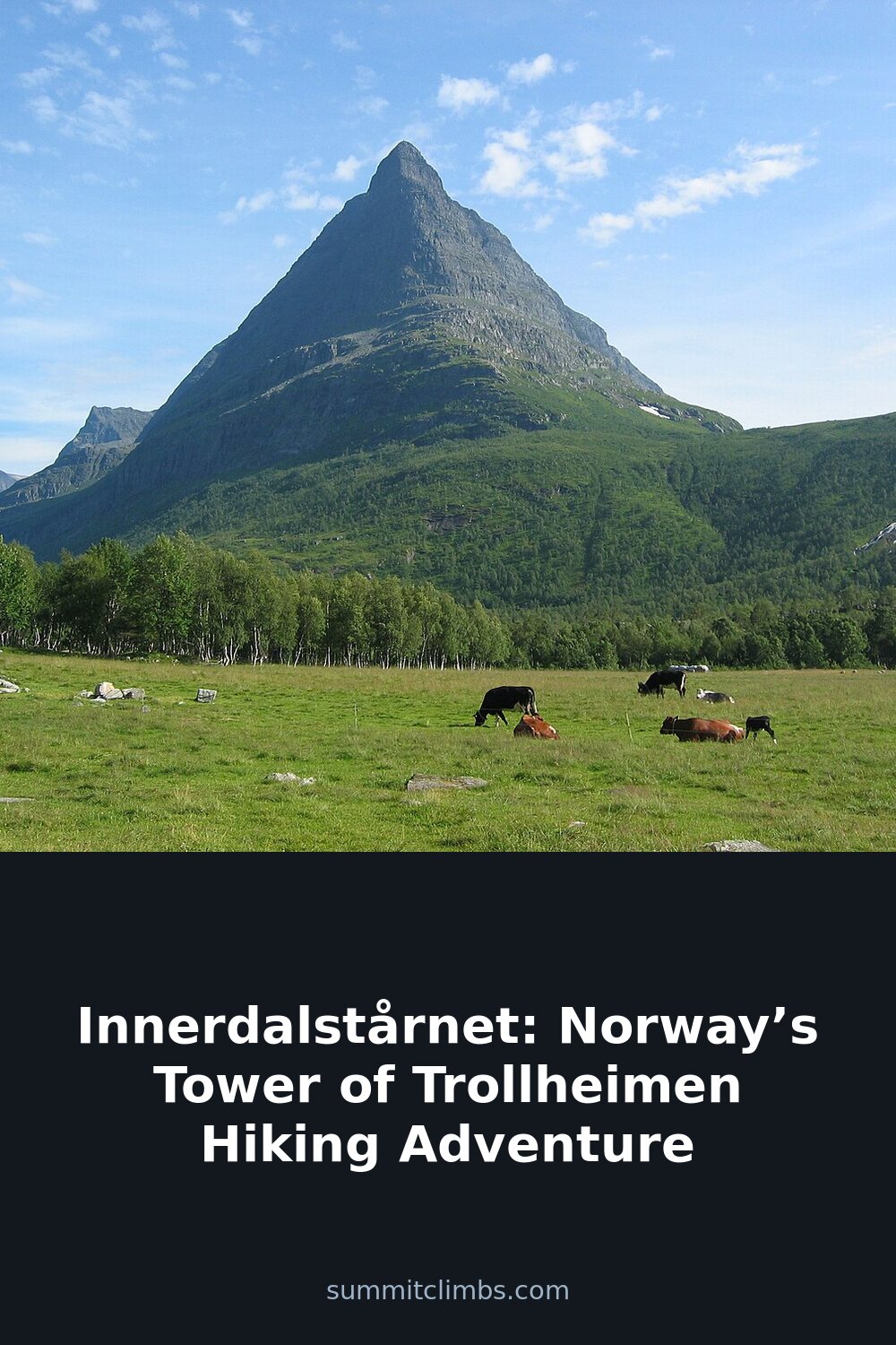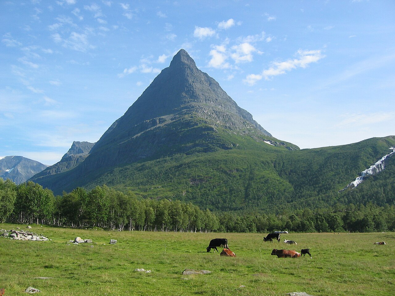
SummitClimbs Field Note: Innerdalstårnet is not a beginner’s peak, nor does it pretend to be. This 1,452-metre tower in the Trollheimen range demands respect, a head for exposure, and a willingness to earn every metre of elevation. But for those who prepare properly, it delivers one of the most striking summit views in Norway—and a genuine sense of having worked for it.
Why This Place Belongs on a Norway Mountain Plan
Trollheimen is one of Norway’s most understated mountain ranges. It lacks the global fame of Jotunheimen or the dramatic fjord-side drops of the Lofoten Islands, but that is precisely its strength. Here, you find long valleys, quiet trails, and peaks that feel personal rather than crowded. Innerdalstårnet sits at the heart of this region, rising from Innerdalen—Norway’s first designated nature reserve, established in 1967. That protected status means the valley has remained largely untouched by development. No chairlifts. No roadside cafes. Just mountains, rock, and the weather doing what it does.
The peak itself is a striking, near-vertical pinnacle that catches the eye from anywhere in the valley. Locals call it the Tower of Trollheimen, and the name fits. It is not the highest summit in the range—Store Trolla, at 1,850 metres, holds that title—but Innerdalstårnet is the one that makes you stop and look. Its silhouette is unmistakable, and the climb to the top is a proper alpine day that rewards judgment, fitness, and a calm head.
The SummitClimbs Snapshot
- Peak: Innerdalstårnet (1,452 m)
- Region: Trollheimen, Møre og Romsdal county, Norway
- Starting point: Innerdalshytta cabin, Innerdalen valley
- Route type: Scrambling with exposed sections; fixed ropes on the crux
- Round-trip time: Full day, typically 7–10 hours depending on pace and conditions
- Season: Late June to September; conditions dictate access outside this window
- Who it suits: Experienced hikers comfortable with scrambling, exposure, and route-finding
- Who it does not suit: Beginners, those with a fear of heights, anyone without proper gear
Route Reality and Local Conditions
The standard approach begins at Innerdalshytta, a historic DNT cabin built in 1889 that sits at the valley floor. From here, the trail follows the valley eastward before turning north and climbing steeply toward the base of the tower. The lower section is straightforward—well-defined path, steady gradient, good footing. Do not let this lull you into complacency. Once the angle increases, the ground becomes a mix of loose scree, blocky talus, and exposed rock slabs that demand careful foot placement.
The crux of the route is the final push to the summit. This is where the scrambling becomes serious. Fixed ropes are in place on the most exposed sections, and you should use them. The rock is generally solid, but wet conditions change everything. Rain, mist, or even morning dew can make the slabs dangerously slippery. If the weather is unstable, turn around. The summit will still be there tomorrow.
From the top, the view is vast and uncompromising. Trollheimen spreads out in all directions—jagged peaks, deep U-shaped valleys, and, on clear days, a glimpse of the distant fjords to the west. The Vinnufonna glacier clings to the slopes of Kongskrona to the south, a reminder of the ice that carved this landscape. Take time to orient yourself. This is not a summit you rush.
For those who prefer a less committing day, the hike to Innerdalsporten—a natural rock gateway at the eastern end of the valley—is a strong alternative. It is roughly a 10-kilometre round trip on good trail, with views of the surrounding peaks and none of the exposure. It is also a fine way to scout the terrain if you plan to attempt the tower the following day.
What to Watch For
Weather moves fast. Trollheimen sits at the intersection of coastal and inland weather patterns. A clear morning can become an afternoon whiteout in under an hour. Check the forecast before you start, but more importantly, watch the sky and make your own decisions. If clouds are building over the peaks by 10 a.m., adjust your plan.
The exposure is real. The summit ridge is narrow and drops away steeply on both sides. This is not a place for casual conversation or loose attention. If you are not comfortable with height and exposure, this is not the peak for you. There is no shame in choosing a different objective.
Navigation requires skill. The main trail is marked, but above the treeline, cairns can be sparse and hard to spot in poor visibility. Carry a map and compass, and know how to use them. Mobile phone coverage is unreliable at best. Do not rely on a phone for navigation.
Gear matters. Sturdy boots with good ankle support are non-negotiable. A helmet is strongly recommended for the scrambling sections, both for your safety and for anyone below you. Gloves help on the fixed ropes, especially if the rock is cold or wet. Pack layers, including a waterproof shell, even if the morning is warm. The summit can be windy and cold regardless of the season.
Self-sufficiency is required. There are no shops, cafes, or emergency services in the valley. Bring all the food and water you need for the day. If you are staying overnight at Innerdalshytta or the smaller Renndølsetra cabin, check in advance whether meals are provided. Do not assume.
Respect the reserve. Innerdalen is protected for a reason. Stay on the trail, pack out all waste, and leave the landscape exactly as you found it. This is not a suggestion; it is both a legal requirement and a matter of basic outdoor ethics.
The SummitClimbs Take
Innerdalstårnet is a classic Norwegian mountain day—demanding, exposed, and deeply rewarding for those who come prepared. It is not a walk-up, and it should not be treated as one. But for hikers with solid scrambling experience, a good fitness base, and the judgment to know when to turn back, this peak offers an experience that stays with you long after you leave the valley.
The setting is part of the appeal. Innerdalen is quiet, remote, and genuinely wild. You will share the trail with few people, even in peak season. The cabins are simple and welcoming. The air smells of rock and moss and cold water. This is Norwegian mountain travel at its most honest.
If you are building a Norway hiking itinerary that prioritizes quality over quantity, put Innerdalstårnet on the list. But respect the tower. It has been standing for hundreds of millions of years. It will not change for you. The onus is on you to be ready for it.
Keep the Trails Alive
Summit Climbs is free — no ads, no paywalls, no sponsored fluff.
Every guide is written from real experience to help your next adventure.
If it helped, a small support means the world and keeps the site running.