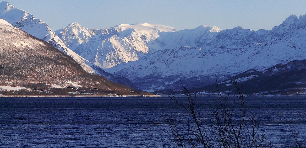
SummitClimbs Field Note: Jiehkkevárri is not a peak you stumble onto. It dominates the skyline between Lyngen and Tromsø municipalities, rising to 1,834 metres with a permanent ice cap and the second-highest prominence of any mountain in Norway. This is a serious, glaciated climb that demands rope skills, weather discipline, and a willingness to turn around. It suits experienced mountaineers and ski-mountaineers who understand that the summit is a privilege, not a right.
Why This Place Belongs on a Norway Mountain Plan
Most visitors to northern Norway focus on the fjords or the Lofoten Islands. Jiehkkevárri sits apart—literally and figuratively. As the highest point in Troms county, it offers a perspective that few other peaks can match: a 360-degree view of the Lyngen Alps, Arctic fjords, and the open ocean. But the real draw is the mountain itself. Its ice cap, deep crevasses, and steep couloirs make it a genuine alpine objective in a region where many summits are walk-ups. For anyone building a serious Norway mountain itinerary, Jiehkkevárri is the kind of peak that separates a trip from an expedition.
The SummitClimbs Snapshot
- Height: 1,834 m (6,017 ft)
- Prominence: Second highest in Norway—this peak rises dramatically from its surroundings
- Location: Border of Lyngen and Tromsø municipalities, about 10 km northeast of Lakselvbukt and 17 km southwest of Lyngseidet
- First ascent: 1899 by Geoffrey Hastings (British) and Elias Hogrenning (Norwegian)
- Best season: June to August for summer mountaineering; winter/spring for ski mountaineering
- Technical requirements: Glacier travel, crevasse rescue, crampon and ice axe skills. Winter ascents require avalanche gear and ski expertise
- Guiding: Strongly recommended unless you have expert-level glacier experience
Route Reality and Local Conditions
Jiehkkevárri is not a hike. The approach alone involves crossing moraines and rocky slopes before you even reach the glacier. Once on the ice, you rope up and navigate a field of crevasses, some hidden beneath snow bridges. The final summit push is steep, exposed, and entirely on snow or ice. Most parties take a full day for the ascent, but a multi-day itinerary is more realistic if you want margin for weather or rest.
In winter, the mountain transforms into a ski-mountaineering objective. The northeast-facing couloir, famously described by the late skier Andreas Fransson as a future classic, offers a steep, high-consequence descent. It is exposed to serac fall from above and is not recommended for ascending. Skiers typically approach via a safer line, then commit to the couloir for the descent. This is expert-level terrain. If you are not comfortable skiing 45-degree slopes with overhead hazard, this is not your line.
Access is via Lyngseidet or Lakselvbukt. Both require a drive on gravel roads plus a significant approach hike. Most climbers fly into Tromsø and then arrange transport to the trailhead. Guided expeditions from Tromsø or Lyngen can handle logistics, equipment, and route-finding—worth considering if you are unfamiliar with the area.
What to Watch For
Glacier Hazard
The permanent ice cap means crevasses are present year-round. Snow bridges can be unstable, especially in late summer. Rope up before stepping onto the glacier, and carry a crevasse rescue kit (pulleys, prusiks, pickets). Do not assume a well-traveled route is safe—conditions change daily.
Weather Instability
Arctic weather is not predictable. Clear skies can turn to whiteout within an hour. Fog is common on the glacier, making navigation difficult. Check the detailed forecast from yr.no and be prepared to abort. SummitClimbs recommends carrying a map, compass, and GPS—do not rely on your phone.
Physical Demands
This is a long, steep day at altitude. You need excellent cardiovascular fitness and leg strength. The approach hike alone can take several hours, and the glacier crossing adds technical fatigue. If you are not comfortable with 8–12 hours of continuous movement, plan a multi-day itinerary.
Serac and Avalanche Risk
On the northeast couloir, seracs (ice cliffs) can collapse without warning. Avalanche danger is also present in winter and spring. Check the avalanche forecast and avoid the couloir if conditions are unstable. For summer ascents, serac fall is less common but still possible—keep a safe distance from ice cliffs.
The SummitClimbs Take
Jiehkkevárri is not a peak for beginners. It is a serious mountaineering objective that rewards preparation and punishes complacency. The views from the top are extraordinary, but the real value is in the process: the approach, the glacier navigation, the decision-making in changing conditions. This is the kind of climb that stays with you, not because of the summit photo, but because of what it demanded.
If you are building a Norway mountain plan and want a peak that tests your skills, Jiehkkevárri belongs on the list. Just be honest about your experience level. If glacier travel is new to you, hire a guide. If you are a strong skier but unfamiliar with Arctic conditions, do a shorter tour first. The mountain will wait. SummitClimbs has seen too many parties underestimate this peak and pay the price in lost time or worse. Respect the ice, respect the weather, and you will earn one of the finest summit days in Scandinavia.
Keep the Trails Alive
Summit Climbs is free — no ads, no paywalls, no sponsored fluff.
Every guide is written from real experience to help your next adventure.
If it helped, a small support means the world and keeps the site running.