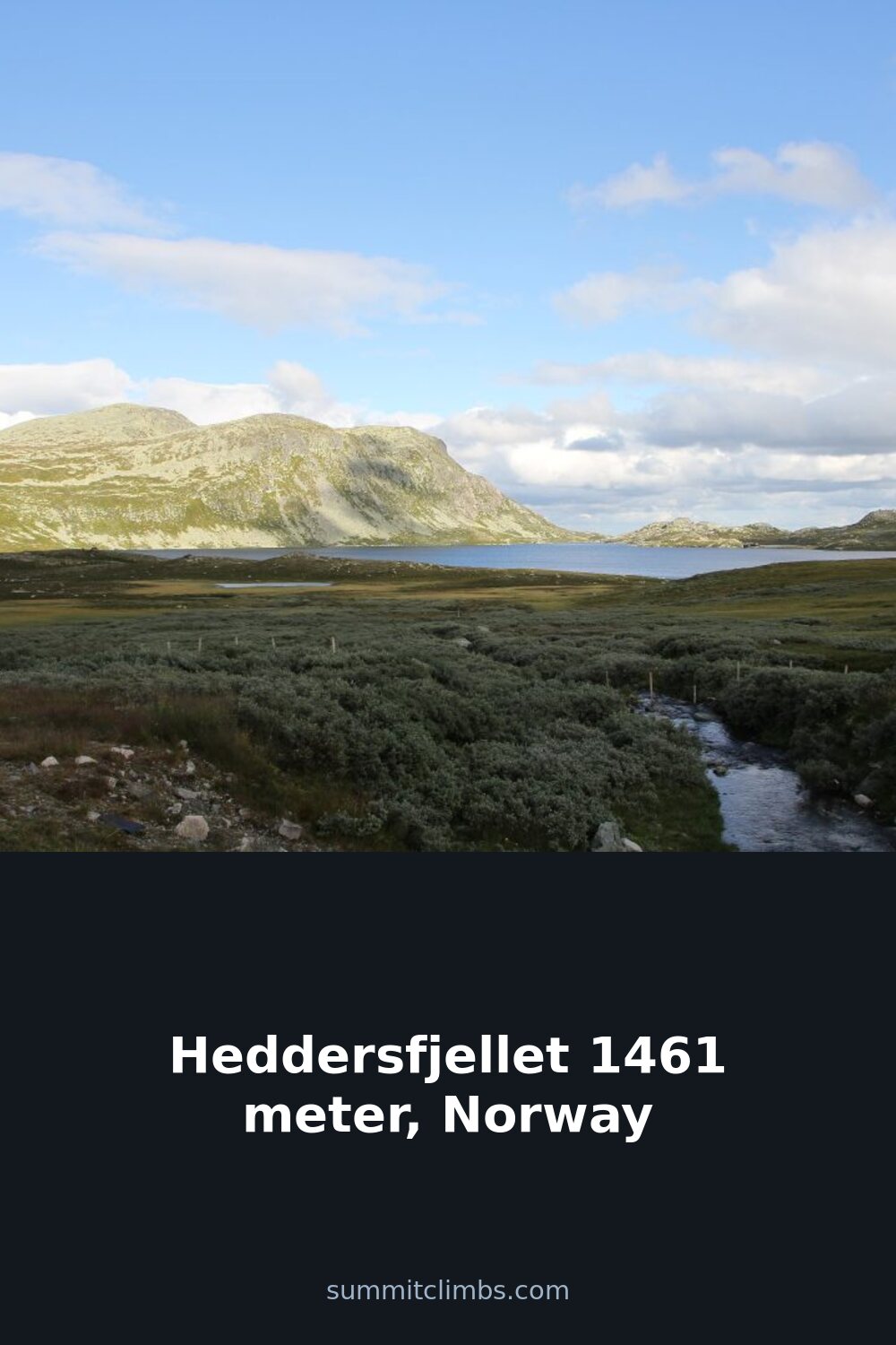
SummitClimbs Field Note: Heddersfjellet sits at 1,461 meters, the highest point between Tuddal and Tinnsjå in Hjartdal municipality. This is not a polished tourist peak; it’s a working mountain with real weather and a notable Ice Age erratic boulder—Hulderhola, also called Hulderkyrkja—that draws a specific kind of hiker. We climbed it in June 2022, got caught in thick fog, and learned the hard way why local knowledge matters. The adventure ended well, but it left us with a clear-eyed respect for this terrain.
Why This Place Belongs on a Norway Mountain Plan
If you’re building a Norway itinerary that prioritizes quiet, off-list summits with geological character, Heddersfjellet earns a slot. The mountain lacks the crowds of more famous Hardangervidda neighbors, yet it offers a legitimate 1,400-meter day with a unique feature: Hulderhola, a massive glacial erratic that locals call the Hulder Church. The rock itself is a conversation piece—left behind by retreating ice, it sits like a sentinel above the valley. For hikers who value solitude and a sense of discovery over summit registers, this is a strong addition. It suits experienced parties comfortable with navigation in poor visibility, or anyone willing to treat a foggy day as part of the experience rather than a failure.
The SummitClimbs Snapshot
- Height: 1,461 meters (4,793 feet)
- Location: Tuddal, Hjartdal municipality, Telemark
- Key feature: Hulderhola / Hulderkyrkja, a glacial erratic boulder from the Ice Age
- Best for: Experienced hikers comfortable with route-finding; parties seeking solitude and geological interest
- Watch out for: Rapid fog banks that can eliminate visibility above treeline; the terrain is open and featureless in cloud
- SummitClimbs tip: Treat the approach to Hulderhola as the main objective; the summit itself is a bonus when weather allows
Route Reality and Local Conditions
The standard approach starts from the Tuddal valley, following marked trails that gain elevation steadily through birch forest and then open moorland. The final push to the summit is a straightforward but exposed ridge walk. In clear conditions, the views over Tinnsjå and the surrounding Telemark peaks are expansive. But clear conditions are not guaranteed. Our June trip started under a promising sky, then the fog rolled in without warning around midday. This is not unusual for the area. The plateau above treeline is wide and lacking in distinctive landmarks, which makes navigation a genuine challenge when the cloud sits low.
We lost the trail entirely for about an hour. The fog turned every contour into a mirror image of the next. Compass and map work became essential—GPS signals can be unreliable in the terrain, and phone batteries drain fast in cold, damp air. The adventure ended well because we had backup navigation tools and the discipline to stop, reorient, and wait for a brief clearing. That clearing let us spot Hulderhola, which we had been aiming for as a secondary objective. The boulder is unmistakable when visible: a massive, angular block of rock that looks dropped from the sky, which it essentially was. We spent time there, then descended carefully as the fog thickened again.
Timing matters. June offers long daylight hours, but snow can linger in shaded gullies into early summer. Late summer and early autumn provide the most stable weather window, though “stable” in this region is relative. Access is straightforward—parking is available near the trailhead in Tuddal, and the route is marked, but the markers are spaced widely above treeline. Do not rely on them alone.
What to Watch For
- Fog: The number one hazard on Heddersfjellet. It can reduce visibility to 10 meters in minutes. Carry a compass, know how to use it, and have a printed map as backup. Phone maps are not reliable here.
- Hulderhola navigation: The boulder is a rewarding destination, but it’s not on the direct summit line. If you want to see it, factor in extra time and a separate route leg. In fog, it’s easy to overshoot.
- Footing: The terrain above treeline is a mix of boulder fields and wet grass. Good ankle support and waterproof boots are non-negotiable. Trekking poles help with stability on the descent.
- Weather shifts: Even on a forecasted “good” day, be prepared for wind and temperature drops. Pack a windproof layer and an insulated mid-layer, even in summer.
- Water sources: There are streams on the lower slopes, but above treeline, water is scarce. Carry at least 1.5 liters per person for a full day out.
The SummitClimbs Take
Heddersfjellet is not a mountain you bag for the summit alone. It’s a mountain you visit for the quiet, the erratic boulder, and the chance to test your navigation skills in a real-world setting. The fog that nearly derailed our trip became the defining memory—not because it was dangerous, but because it forced us to slow down, pay attention, and engage with the landscape on its own terms. That kind of experience is rare on more popular peaks. If you’re the type of hiker who values that, and you’re willing to treat a lost hour as part of the story rather than a mistake, Heddersfjellet will reward you. If you want a straightforward summit with guaranteed views, choose a different hill. For everyone else: pack a compass, respect the weather, and make time for the Hulder Church.
Keep the Trails Alive
Summit Climbs is free — no ads, no paywalls, no sponsored fluff.
Every guide is written from real experience to help your next adventure.
If it helped, a small support means the world and keeps the site running.