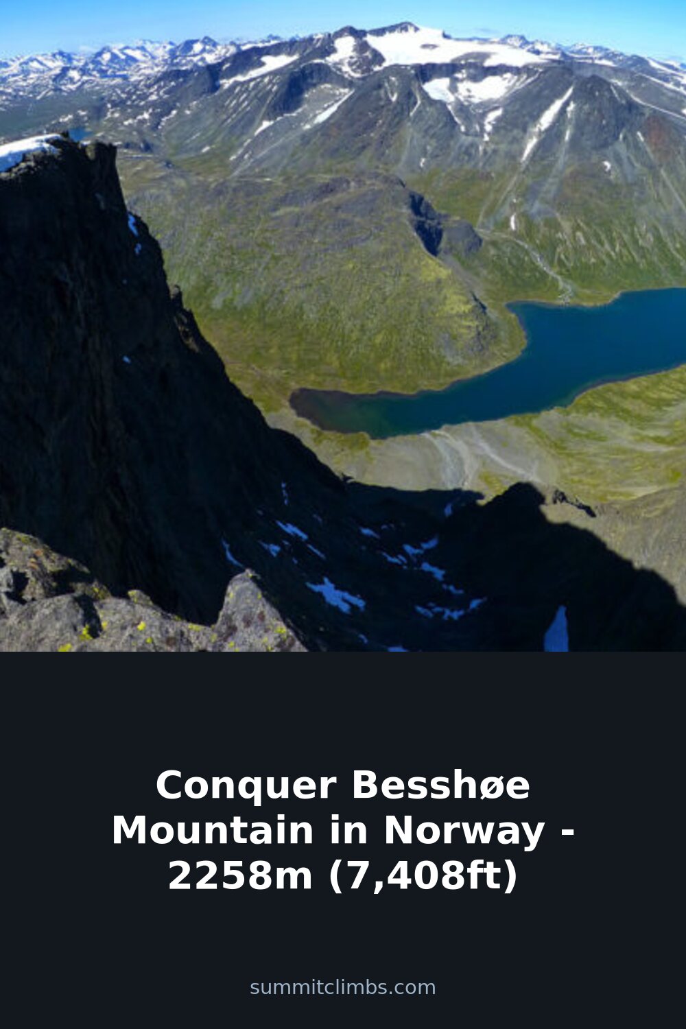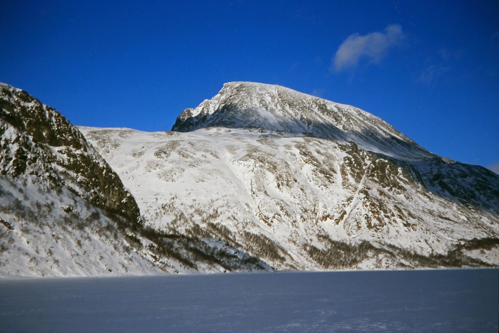
SummitClimbs Field Note: Besshøe is not a technical climb, but it is a long, rugged day in the Norwegian high country. The 23-kilometer route demands solid fitness, good navigation, and a weather window that can close fast. This is a peak for hikers who want solitude and a real mountain challenge, not a quick summit photo.
Why This Place Belongs on a Norway Mountain Plan
Besshøe sits above the famous Besseggen ridge, but it gets far fewer boots. At 2,258 meters, it offers big views over Gjende Lake and the surrounding Jotunheimen peaks without the crowds. If you have already done Besseggen and want something quieter, or if you simply want a full-day mountain walk with genuine alpine character, Besshøe delivers. The route starts near Tessand in Innlandet and stays high for most of the day. You will cover big elevation changes and loose boulder fields, so this is not a casual stroll. But for experienced hikers who plan carefully, it is one of the most rewarding day hikes in the eastern Jotunheimen.
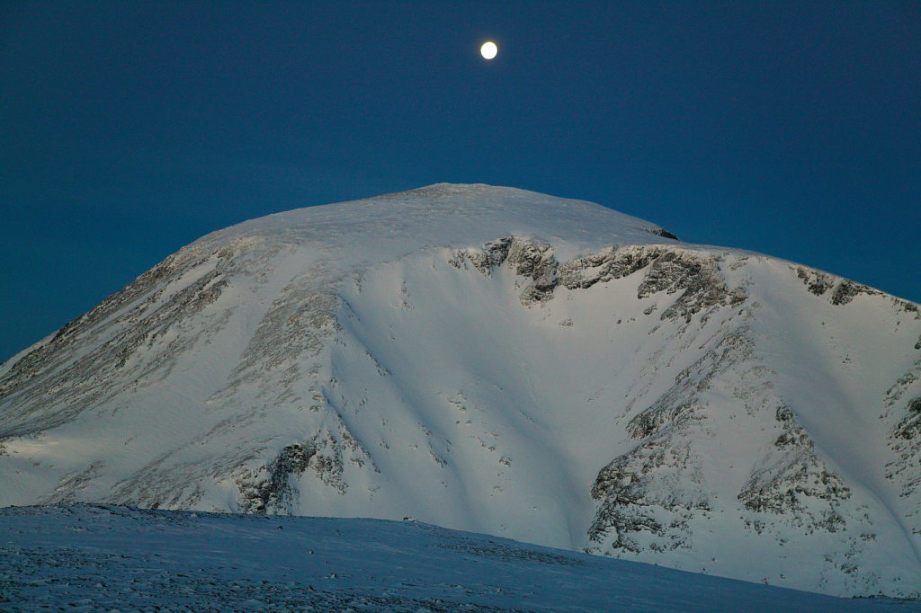
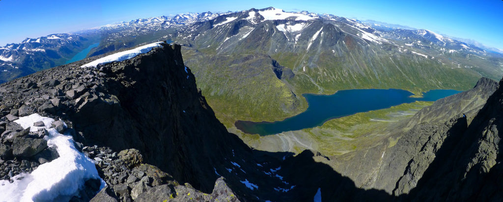
The peak itself is a broad, windswept dome of rock and scree, characteristic of Jotunheimen’s high plateau terrain. Unlike Besseggen’s knife-edge ridge, Besshøe offers a more open, expansive summit experience. You gain the top after a sustained climb and a traverse that feels genuinely alpine in scale. The lake below—a deep, glacier-fed blue—is a constant companion on the ascent, and on clear days, the view stretches across the entire Jotunheimen massif. This is a peak for hikers who understand that the reward comes from the full day’s effort, not from a short walk to a viewpoint.
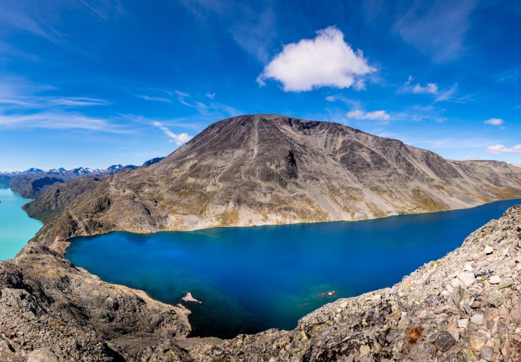
What makes Besshøe special for SummitClimbs is the balance it strikes. It is accessible enough for a fit hiker with good route sense, but remote enough that you feel alone on the mountain. The trail does not see the same traffic as Besseggen, even in peak season. You will likely share the route with a handful of other parties at most, and you may have the summit entirely to yourself. That solitude, combined with the scale of the landscape, gives Besshøe a character that many Norwegian peaks lack.
The SummitClimbs Snapshot
- Height: 2,258 meters (7,408 feet)
- Route length: 23 kilometers round trip
- Average time: 8 hours, but expect longer in poor conditions
- Difficulty: Hard. Big elevation gain, boulder fields, and route-finding challenges
- Season: July to September. Outside this window, snow and ice make navigation dangerous
- Dogs: Not allowed on this trail
- Solitude: High. You will likely see few other people
This is a day that suits hikers with experience of long, high-altitude routes. If you have done other Jotunheimen classics—like Galdhøpiggen or Glittertind—Besshøe will feel familiar in its demands but different in its character. The route is less direct, more exposed to weather, and far quieter. That combination makes it a strong addition to a Norway mountain plan, but only for those who come prepared.
Route Reality and Local Conditions
The trail climbs steadily from the start, with no easy warm-up. You gain elevation quickly and then spend hours traversing rocky terrain. The path is not always clearly marked—cairns exist, but they can be sparse in sections. In mist or low cloud, it is easy to lose the route entirely. Besshøe sits in a part of Jotunheimen where weather changes fast. Strong winds are common, even on days that start calm. Rain can arrive without warning, and temperatures drop sharply at the summit. Plan for full waterproofs, warm layers, and a reliable map or GPS. The boulder fields demand careful footwork; wet rock is slippery, and loose stones shift under weight. Trekking poles help with balance, especially on the descent.
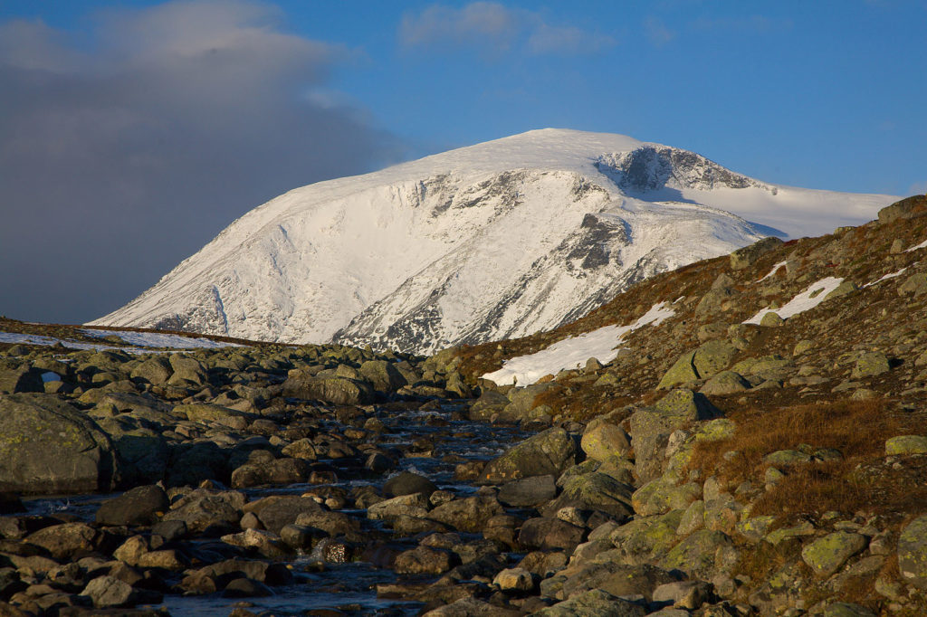
Most hikers start early—before 7 a.m.—to allow time for the full route and to avoid afternoon weather. The walk is long enough that fatigue becomes a factor in the final hours. Carry more water than you think you need; there are no reliable streams near the summit. Food, sun protection, and a headlamp are standard essentials. The terrain does not forgive shortcuts or rushed decisions.
The ascent from Tessand follows a well-worn but not heavily marked path through birch forest and then onto open scree. Once above treeline, the route becomes a series of long, rising traverses across boulder fields and rocky ridges. The final push to the summit is a steep scramble over loose stone, but it is not technical—no ropes or climbing skills are needed. The descent retraces the same line, which means you face the same boulder fields when tired. That is where most accidents happen. SummitClimbs advises taking the descent slowly, using poles for stability, and stopping to rest before the trickiest sections.
Water is a real consideration on Besshøe. There are small streams in the lower sections, but they dry up by mid-summer. Carry at least two liters per person, more on hot days. The sun at this latitude is intense, even when the air is cool. Sunburn and dehydration are common problems for hikers who underestimate the exposure.
What to Watch For
Navigation
The trail markers can disappear for stretches. In clear weather, you can follow the ridgeline visually, but in fog, you need solid navigation skills. Study the route beforehand and have a backup plan. SummitClimbs recommends carrying both a paper map and a charged GPS device. Do not rely solely on a phone—cold drains batteries fast.
Weather
Besshøe catches wind from all directions. Even in July, summit temperatures can drop to near freezing with wind chill. Check the forecast in the morning and again before you start the descent. If clouds build early, consider turning back. The summit is not worth a rescue.
Boulder Fields
The upper slopes are covered in loose rock. Take your time, watch your footing, and avoid stepping on wet or moss-covered stones. A twisted ankle here means a long, slow walk out. Poles help, but they are not a substitute for careful movement.
Timing
Eight hours is an average for fit hikers in good conditions. Add time for breaks, photo stops, and slower sections. If you are not used to 23-kilometer days with significant elevation gain, plan for nine or ten hours. Start early enough that you are off the summit by early afternoon.
One factor that catches many hikers off guard is the psychological toll of the descent. The route feels endless when you are tired, and the boulder fields seem larger on the way down. Break the return into sections—aim for a landmark, rest briefly, then move to the next. This keeps morale steady and reduces the chance of a mistake.
The SummitClimbs Take
Besshøe is a classic Norwegian mountain day for the right person. It rewards endurance and route sense with big views and real solitude. If you want a quiet alternative to the busier Jotunheimen trails, this is a strong choice. But it is not a beginner hike, and it is not a place to test new gear or push your limits without preparation. Respect the distance, the weather, and the terrain, and Besshøe will give you one of the finest summit experiences in the region. SummitClimbs rates it as a top pick for experienced hikers who value space, challenge, and genuine mountain character over convenience.
For those planning a Norway mountain trip, Besshøe fits well as a second or third day after a warm-up hike. It is not a peak to tackle on your first day in Jotunheimen—your legs need to be acclimated to the elevation and the rocky terrain. Pair it with a shorter, lower-altitude walk earlier in the week, and save Besshøe for when you are settled into the rhythm of the mountains. That approach will give you the best chance of a clean, safe, and memorable day.
In the end, Besshøe is a hike that asks for respect and repays it generously. It does not offer the dramatic ridge of Besseggen or the sheer height of Galdhøpiggen, but it offers something rarer: a full day in the high country, alone with the wind and the views, with no crowds and no shortcuts. For the hiker who understands that value, Besshøe is one of the best days in Norway.
Keep the Trails Alive
Summit Climbs is free — no ads, no paywalls, no sponsored fluff.
Every guide is written from real experience to help your next adventure.
If it helped, a small support means the world and keeps the site running.