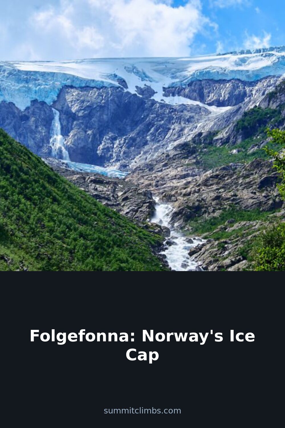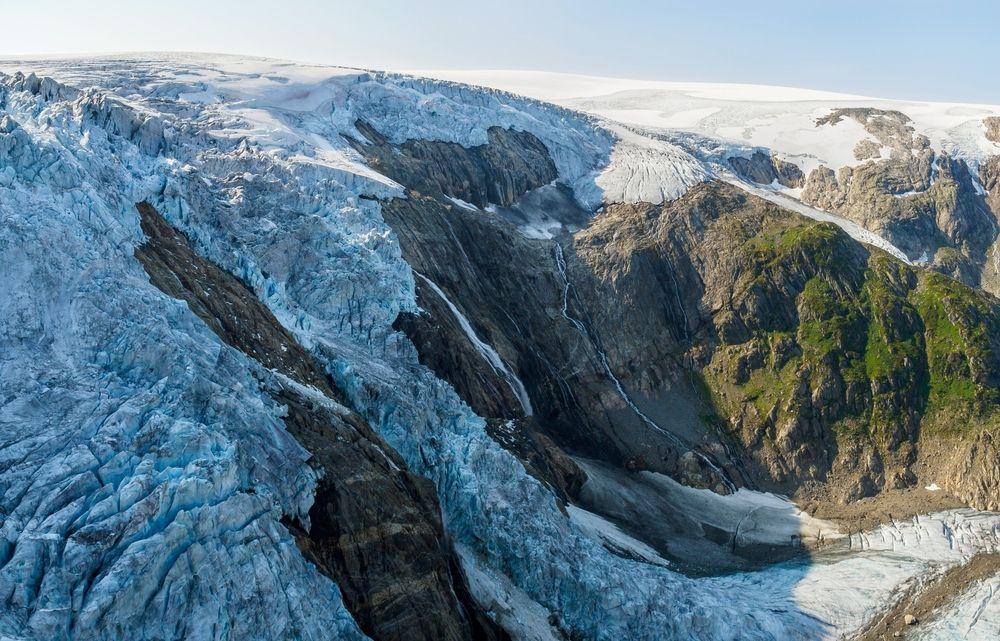
SummitClimbs Field Note: Folgefonna is not a single slab of ice but a high-elevation plateau system—three interconnected glaciers (Nordre, Midtre, and Søndre) that together blanket roughly 200 square kilometres of the Folgefonna peninsula in Vestland county. Søndre Folgefonna, the southern component, ranks as the third-largest single glacier on the Norwegian mainland. In 2005, Norway established Folgefonna National Park to protect not only the ice but also the surrounding fjords, valleys, rivers, and mountain terrain that define this part of western Norway. This is a living landscape where ancient geology meets modern-day ice travel, and where the margin for error is thin.
Why This Place Belongs on a Norway Mountain Plan
Folgefonna sits at the intersection of deep time and immediate, practical mountain travel. The bedrock beneath the ice is ancient—hundreds of millions to over a billion years old—shaped by continental collisions long before the first humans walked this coast. During the last ice ages, enormous ice sheets carved the deep valleys and fjords that now frame the glacier, including the Hardangerfjord that runs along its western edge. When those sheets retreated roughly 10,000 years ago, they left behind the U-shaped valleys and steep slopes that make western Norway such a dramatic place to move through.
Today’s Folgefonna is a remnant of those ice sheets, still actively shaping the land. Glacial rivers and waterfalls feed into the fjords below, and the ice continues to grind away at the underlying rock. Recent decades have seen measurable retreat as the climate warms, exposing fresh moraine fields and valleys that haven’t seen sunlight in centuries. For the mountain traveller, this means a landscape in transition—one where the routes, access points, and hazards shift year to year.
The SummitClimbs Snapshot
- Location: Folgefonna peninsula, Vestland county, western Norway. Bounded by Hardangerfjord to the west and valleys leading to Odda and Rosendal to the east and south.
- Size: Three interconnected plateau glaciers covering roughly 200 km². Søndre Folgefonna is the third-largest single glacier on mainland Norway.
- Protected area: Folgefonna National Park, established 2005. Protects the ice cap and surrounding fjord, valley, and mountain ecosystems.
- Best season for guided travel: June through October. Conditions outside this window are significantly more hazardous and require advanced skills.
- Primary access points: Jondal (west side, via Glacier Road), Odda/Buer (east side), Rosendal (south, via the Folgefonn Centre).
- Who this suits: Experienced hikers with glacier travel experience or those willing to hire a certified guide. Not for solo scramblers or those without crevasse rescue knowledge.
Route Reality and Local Conditions
Getting to Folgefonna requires planning, but the access is more straightforward than many Norwegian ice caps. The most common entry is from Jondal on the western shore of Hardangerfjord. From there, the Glacier Road climbs steeply toward the plateau, reaching roughly 1,200 metres elevation near the site of a former ski centre. This road is the main staging area for guided hikes in summer. On the eastern side, the town of Odda and the Buer valley provide access to the glacier’s outflow tongues and the lower valleys that drain the ice. Rosendal, to the south, offers the Folgefonn Centre—a good place to get oriented before heading into the park.
Public transport options exist during summer, with bus and boat combinations connecting Bergen, Norheimsund, and Jondal. These services are seasonal and limited, so check schedules carefully before committing to a plan. If you’re driving, note that the Glacier Road is narrow, steep in sections, and can be closed by weather at short notice.
Do not walk on the glacier without a certified guide or equivalent mountaineering experience. This is not a suggestion; it is the single most important piece of advice for anyone visiting Folgefonna. Hidden crevasses are often covered by thin snow bridges that can collapse under body weight. Ice movement is unpredictable, and seracs or rockfall can release without warning. Weather around ice fields changes rapidly—clear skies can become white-out conditions in under an hour, eliminating all visibility and making navigation impossible without instruments.
Guided hikes are offered from June through October by local teams such as Folgefonni Breførarlag. They provide crampons, ropes, and safety gear, and they know the current state of the crevasses and snow bridges. If you are not an experienced glacier traveller, this is the only safe way onto the ice. Multi-day traverses between valleys are possible but require solid route-finding skills, weather awareness, and a willingness to turn back when conditions shift.
What to Watch For
- Weather volatility: Western Norway’s maritime climate means fog, rain, and high winds can move in fast. Even in July, be prepared for near-freezing temperatures and limited visibility on the plateau.
- Crevasse hazard: The snow bridges that cover crevasses are weakest in late summer and after warm spells. Do not assume a flat surface is safe.
- River crossings: Glacial meltwater streams can rise rapidly on warm afternoons. Plan crossings for early morning when flow is lower.
- Rockfall: The ice retreat is exposing unstable moraine and cliff faces. Stay clear of the ice edge where possible, especially in warm weather.
- Navigation: GPS and maps are essential. White-out conditions can disorient even experienced parties. Carry a compass and know how to use it.
- Respect the park: Folgefonna National Park protects a fragile environment. Leave no trace, stay on established routes, and do not disturb wildlife or vegetation.
The SummitClimbs Take
Folgefonna is a serious mountain destination that rewards preparation and respect. It is not a place for casual sightseeing on the ice, but it is accessible enough for fit hikers who are willing to work with a guide or bring the right skills. The surrounding valleys and fjords offer excellent walking in their own right, and the glacier serves as a dramatic backdrop even if you never set foot on it.
For the mountain traveller who wants to understand how ice shapes a landscape—and who wants to see that process happening in real time—Folgefonna delivers. The ice is retreating, the valleys are changing, and every season brings a slightly different route. That is the reality of traveling on active glaciers, and it is worth understanding before you go.
SummitClimbs recommends this destination for experienced hikers and glacier travellers who plan thoroughly, respect the conditions, and treat the ice with the caution it demands. If that describes your approach, Folgefonna will reward you with one of the most dramatic and instructive mountain environments in Scandinavia.
Keep the Trails Alive
Summit Climbs is free — no ads, no paywalls, no sponsored fluff.
Every guide is written from real experience to help your next adventure.
If it helped, a small support means the world and keeps the site running.