SummitClimbs Field Note: The Haukeliseter to Finse traverse is a 100-kilometer crossing of the Hardangervidda plateau—one of Europe’s last true high-altitude wildernesses. This is not a weekend stroll. It is a multi-day, self-reliant journey across open tundra where weather shifts faster than a train schedule and the nearest road is often a day’s walk away. SummitClimbs rates this as a serious, rewarding route for experienced mountain walkers who understand Norwegian conditions. The trail is marked but not patrolled; the huts are spaced for disciplined stages; and the payoff is a raw, silent landscape that few travelers ever see.
Why This Place Belongs on a Norway Mountain Plan
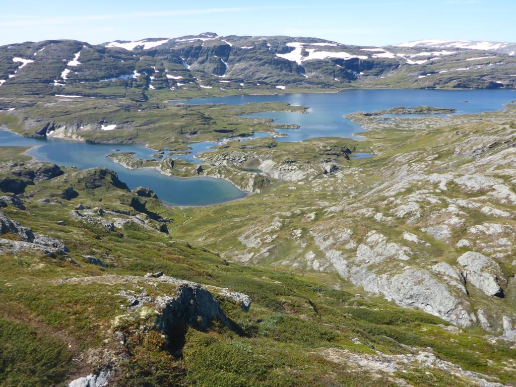
Hardangervidda is northern Europe’s largest mountain plateau, a high-altitude desert of lichen, rock, and shallow lakes that sits above the treeline for its entire span. The Haukeliseter-to-Finse route cuts through its spine, linking the southern DNT lodge at Haukeliseter with the remote railway village of Finse in the north. This is not a scenic loop or a summit bagging trip—it is a genuine crossing. You start in one valley system, finish in another, and spend days moving through a landscape that feels older than roads.
What makes this trail stand out is its isolation. There are no villages, no shops, no roads after the first few kilometers. The only human presence comes from the DNT’s network of unserviced and staffed huts, spaced roughly a day’s walk apart. This is a place where you carry your own safety, where a compass and map are not backups but primary tools, and where the silence is so complete that you hear your own heartbeat on the wind. For walkers who want to test their mountain craft against a real, raw environment, this route belongs on a short list.
The SummitClimbs Snapshot
- Distance: Approximately 100 km (62 miles), point-to-point.
- Duration: 5–7 days, depending on weather and hut bookings.
- Difficulty: Strenuous. Requires solid navigation, fitness for 10–18 km days over uneven terrain, and experience with cold, wet, or whiteout conditions.
- Best season: Late June to mid-September. Snow lingers on the high sections well into July.
- Huts: DNT staffed and unserviced huts at key intervals. Booking essential for staffed huts in peak season.
- Access: Start at Haukeliseter (reachable by car or bus from Oslo/Bergen). Finish at Finse, which is accessible only by the Bergensbanen railway line.
- Navigation: Marked trail (red Ts on rocks), but visibility can drop to 20 meters in fog. Map and compass mandatory.
Route Reality and Local Conditions
Haukeliseter to the First Plateau
The trail begins at Haukeliseter, a DNT lodge set beside Lake Ståvatn at the southern edge of Hardangervidda. From here, the path follows a series of valleys and lake shores, crossing gentle terrain that lets you ease into the journey. The first day is a good test of your gear and your legs—expect wet sections, small streams, and a landscape that quickly opens into the vast, rolling tundra. In summer, wildflowers line the trail, but don’t let the beauty fool you: the weather can turn in minutes.
The Heart of Hardangervidda
Once you clear the initial valleys, the route enters the core of the plateau. This is where the real work begins. The terrain becomes rockier, the wind stronger, and the trail less forgiving. You will cross broad, featureless plains where the only landmark is the next cairn. The Hårteigen peak—a flat-topped mountain visible from miles away—serves as a natural waypoint. Experienced walkers with good conditions may detour to its summit for a panoramic view of the plateau, but this is a serious addition that should not be attempted in poor visibility or by solo hikers without solid scrambling skills.
The DNT huts along this section are spaced at intervals that match a strong day’s walk: typically 12–18 km apart. The staffed huts offer meals, drying rooms, and bunk beds; the unserviced huts provide basic shelter, a stove, and sleeping mats. You must carry your own sleeping bag liner and food for unserviced stops. Water is plentiful from streams and lakes, but treat or boil it.
Approaching Finse
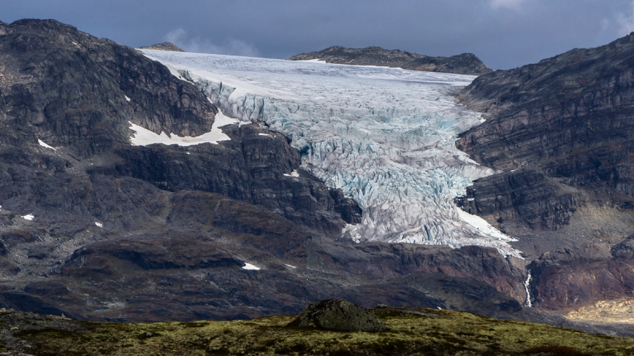
As you near the northern edge of the plateau, the trail descends toward Finsevatnet lake and the village of Finse itself. The final day offers dramatic views of the Hardangerjøkulen glacier, a massive ice cap that dominates the northern skyline. The descent is not technically difficult, but the terrain can be boggy and slippery after rain. Finse is a small cluster of buildings—a train station, a DNT lodge, and a few private cabins—and it feels like a genuine outpost. There is no road access; the only way in or out is the Bergensbanen railway.
What to Watch For
- Weather is the real hazard. Hardangervidda is notorious for rapid, severe changes. A clear morning can turn into a gale-driven sleet storm by noon. Carry full waterproofs, warm layers, and a bivvy bag or emergency shelter even on a fine day.
- Navigation in fog. The plateau is flat and featureless in many sections. When fog rolls in—and it will—visibility drops to a few meters. The trail markers (red Ts painted on rocks) are spaced far apart. You must be confident with map and compass. GPS is a backup, not a primary tool.
- River crossings. Several streams and rivers cross the trail. After heavy rain or snowmelt, they can rise quickly. Assess each crossing carefully; wading is often required. A pair of lightweight water shoes or sandals can save your boots from a soaking.
- Hut etiquette and bookings. Staffed huts require advance booking in summer. Unserviced huts operate on a first-come, first-served basis. If you arrive late and the hut is full, you may need to sleep in the entryway or pitch a tent. Carry a tent as a backup.
- Wildlife. Reindeer herds are common on the plateau. You may also see arctic foxes and a variety of birds. Keep your distance and do not feed any animals.
The SummitClimbs Take
The Haukeliseter to Finse trail is a classic for a reason. It offers a genuine wilderness crossing in a country where such journeys are increasingly rare. But it is not for everyone. This route demands self-sufficiency, solid navigation skills, and a tolerance for discomfort. The rewards are real: days of silent walking across a landscape that feels both ancient and immediate, the camaraderie of shared hut evenings, and the deep satisfaction of completing a traverse that requires real effort.
For walkers who have cut their teeth on shorter Norwegian trails or alpine hut-to-hut routes in other countries, this is a natural next step. For those new to mountain travel, we recommend building experience on easier, lower-altitude routes first. Hardangervidda is not a place to learn basic skills—it is a place to apply them.
SummitClimbs advises planning your trip around hut availability rather than calendar dates. Book early, pack conservatively, and treat the plateau with the respect it demands. If you do, you will return with more than photos—you will return with a story that belongs entirely to you.
Keep the Trails Alive
Summit Climbs is free — no ads, no paywalls, no sponsored fluff.
Every guide is written from real experience to help your next adventure.
If it helped, a small support means the world and keeps the site running.