
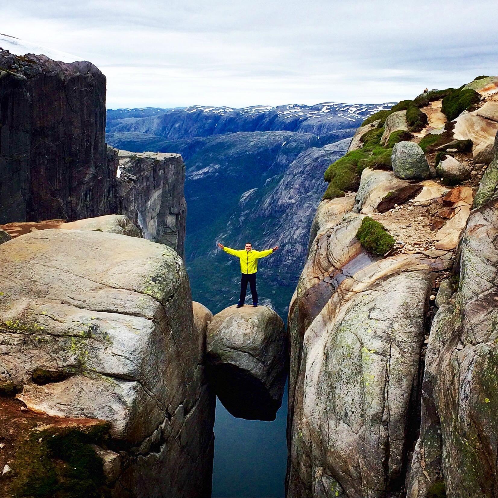
SummitClimbs Field Note: Kjerag is the mountain at the head of Lysefjorden in Sandnes, Rogaland: a plateau rising to 1,132 m whose northern side drops almost 1,000 m straight to the fjord. Its famous Kjeragbolten, a 5 m³ boulder wedged in a crevice, hangs over the abyss, and you can step onto it without any equipment. The T-marked path from Øygardstølen is about 9–10 km there and back, 5–7 hours with 621 m of ascent over three steep ridges, with several hundred metres of fixed chain. It is a demanding hike, and the road there is closed in winter.
The Majesty of Lysefjorden
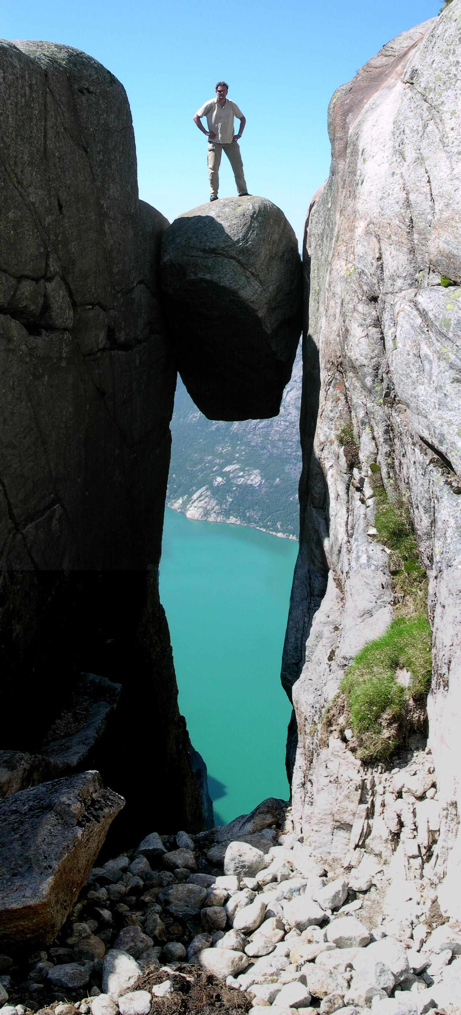
Kjerag stands on the south shore of Lysefjorden, just southwest of the village of Lysebotn. Its old name, Kiragg, is explained by the small streams that fall from the mountain and dissolve into spray like the shaggy coat of a kid goat. Kjeragbolten lies about 300 m from Nesatindane (984 m), the point at the edge of the fjord; the boulder is a glacial deposit left during the last glaciation and wedged in place as the land rebounded. Below it there is a sheer drop, then a steep slope all the way down to Lysefjorden.
Kjerag is also famous among BASE jumpers: from 1994 to 2016 around 50,000 jumps were made from Nesatindane, and the number was approaching 55,000 in 2018, with more than 100 accidents registered. Climbers come too, for the hard routes up the great wall.
Kjerag at a Glance
- Height: 1,132 m (plateau high point); the cliff drops almost 1,000 m to Lysefjorden
- Location: Sandnes, Rogaland; south side of Lysefjorden, near Lysebotn
- Start: Øygardstølen car park and visitor centre on Road 500
- Distance: about 9.3–10 km, out and back
- Time: about 5–7 hours
- Ascent: about 621 m in total
- Grade: demanding; T-marked, long, much bare rock; fixed chains
- Season: June to October; Road 500 from Sirdal to Lysebotn closes with the first snow (October/November) and usually opens mid-May
- Shelter: a stone emergency hut halfway
The Route From Øygardstølen
The route crosses barren, rocky terrain with lots of bare, ice-polished rock; it is heavy going and long. From the car park at Øygardstølen, the T-marked path starts with a steep climb over the first ridge, drops to Litle Storedal, and climbs steeply again. From the end of Storedalen a steep ridge leads up onto the Kjerag massif itself, with airy views of Lysefjorden the whole way. Once on top, the path crosses open, easy terrain to the cairn on Nesatind; Kjeragbolten lies about 300 m south of it. Stavanger Turistforening has built a cairn with signposts on the plateau to help you find the way; don’t build your own cairns, as they can mislead people in fog. Return the same way.
Several hundred metres of chain have been fixed along the path to hold on to, and some people find these sections hard on the way down, so allow extra time if you are afraid of heights. The chains are removed around 15 October and put back when the snow has melted, usually in mid-May. Halfway along is a stone emergency shelter with a wood stove and wool blankets; the benches are locked, and in an emergency you get the code by calling 113.
Before You Go
- Getting there: it is roughly a 2-hour drive from Stavanger (road closed in winter); in summer the tourist ferry runs from Lauvvik to Lysebotn.
- Crowds: midsummer weekends are the busiest; at Kjeragbolten there can be a long queue for the photo.
- Kjeragbolten: it is easy to step onto from the side, but there is a sheer drop below; only go if you are comfortable.
- Fog: the plateau is easy to get lost on in poor visibility; follow the T-marks and official cairns.
The SummitClimbs Take
Kjerag is the wilder twin of Preikestolen: a longer, rougher day over three ridges to a 1,000 m wall above Lysefjorden and a boulder you can stand on if you dare. Go between June and October, start early, and take the chains slowly on the way down.
Route facts from the UT.no route to Kjerag and Kjeragbolten; other facts from Wikipedia (Kjerag), Kjeragbolten and Norwegian Wikipedia.