

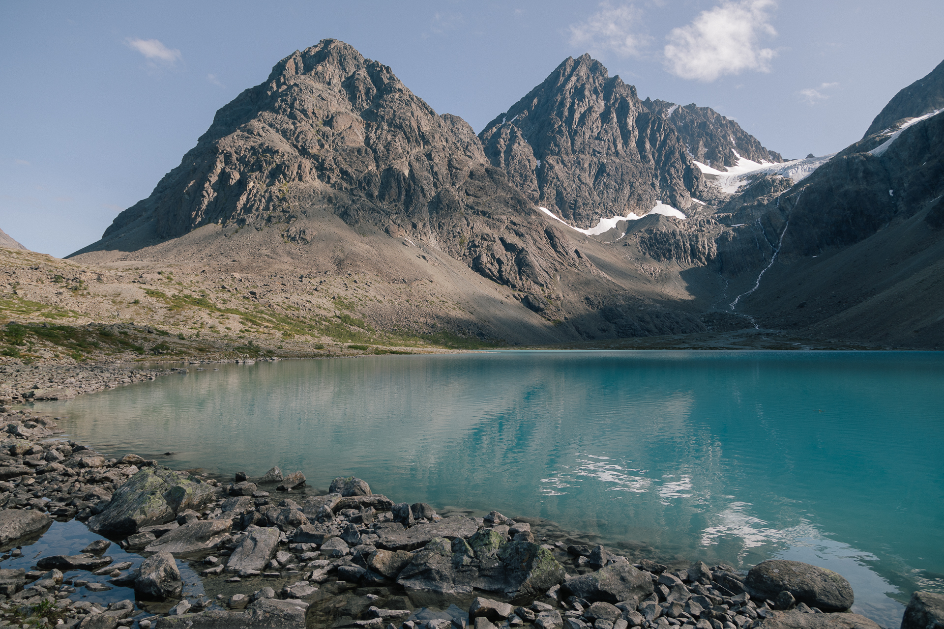
SummitClimbs Field Note: The Lyngen Alps (Lyngsalpan, Ittuvárit in Northern Sami) are a jagged, glaciated range at least 90 km long and 15–20 km wide on the Lyngen Peninsula in Troms, east of Tromsø, between Lyngenfjorden and Ullsfjorden. They hold 140 glaciers and the highest mountain in Troms, Jiehkkevárri (1,833 m). They are famous for ski touring and alpine climbing, but there are easy walks too: the most popular is the hike to the turquoise lake Blåvatnet, about 9 km there and back with only 178 m of ascent.
Gabbro, Glaciers and Two Fjords
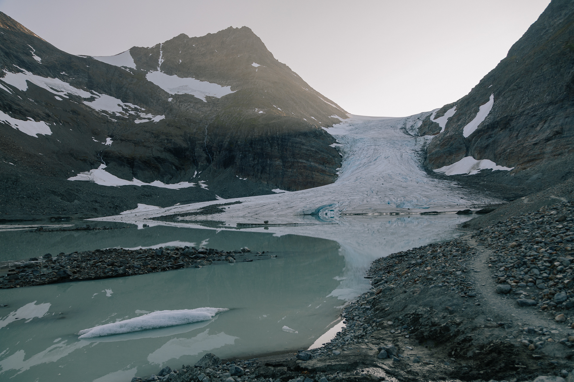
The range runs north to south along the western shore of Lyngenfjorden, through Lyngen, Balsfjord, Storfjord and Tromsø municipalities. Its rugged core is a belt of ophiolitic gabbro, hard rock that was once the crust under an ancient ocean, raised during the Caledonian mountain-building and then carved by ice. During the last ice age the peninsula was probably covered by ice 1,000–1,200 m thick. Today 140 glaciers cover about 141 km²; the largest are Gamvikblåisen and Strupenbreen in the outer part, and Fornesbreen and the Jiehkkevárri glacier complex in the interior.
The mountains block most of the precipitation coming from the west, so the west side is wetter and the east side drier: about 850 mm a year at Ullsfjorden against about 600 mm at Lyngseidet. The Lyngen Alps Landscape Protection Area, established in 2004, covers 961 km² and also protects Sami reindeer herding.
The Lyngen Alps at a Glance
- Location: Lyngen Peninsula, Troms; east of Tromsø, between Lyngenfjorden and Ullsfjorden
- Size: at least 90 km long, 15–20 km wide
- Highest peak: Jiehkkevárri, 1,833 m (1,834 m in Norwegian sources), the highest in Troms
- Highest in the north: Store Lenangstind, 1,625 m
- Glaciers: 140, about 141 km²
- Protected: Lyngsalpan Landscape Protection Area, 961 km² (2004)
- Getting there: express boat from Tromsø to Nord-Lenangen, buses, and ferries Breivikeidet–Svensby and Olderdalen–Lyngseidet
- Known for: ski touring, alpine climbing, fishing and northern lights
The Easy Classic: Blåvatnet
The glacier-fed lake Blåvatnet in Strupskardet, below the Lenangsbreen glaciers and between Nordre Jægervasstind and Lenangstind, is one of the Lyngen Alps’ main attractions. Its intense turquoise colour comes from fine glacial silt carried by the meltwater from Lenangsbreen. From the parking area at Sør-Lenangsbotn, follow the path marked with red-topped cairns. It is about 8.9 km there and back with 178 m of ascent, about 2 hours each way, rated medium; the last part up to the lake crosses some bigger boulders and scree. The best time is summer or autumn, on a sunny afternoon. You can also make a detour via the lake Aspevatnet.
Alpinism in the Arctic
The Lyngen Alps are true alpine terrain and popular with extreme skiers. The British climber William Cecil Slingsby made first ascents of many of the peaks and called Jiehkkevárri the Scandinavian answer to Mont Blanc. Elizabeth Le Blond also climbed here and wrote about it in Mountaineering in the Land of the Midnight Sun. Piggtinden was first climbed in summer 1920 by Henning Tønsberg and Karl Rubenson; the philosopher Peter Wessel Zapffe climbed it in 1923. For the higher peaks, glacier travel and climbing skills, or a guide, are essential.
Wildlife and History
The high mountains are species-poor, with ptarmigan, ravens and snow buntings, while the valleys and forests hold moose, hares, red foxes, wolverine, lynx, otters and more. Lyngen has long been a meeting place of Sami, Kven and Norwegian cultures, “the meeting of three tribes”, and in September 2024 the mountains received official Northern Sami and Kven names, Ittuvárit and Yykeänvaarat.
The SummitClimbs Take
The Lyngen Alps are Arctic Norway’s great mountain range: ski touring in spring, glaciers and serious peaks in summer, and an easy walk to Blåvatnet for everyone. Start with the lake, come back with skills or a guide for the summits.
Facts from Wikipedia (Lyngen Alps) and Norwegian Wikipedia (Lyngsalpan); Blåvatnet route from the UT.no route to Aspevatnet and Blåvatnet.