SummitClimbs Field Note: Gaustatoppen is a mountain that asks you to pay attention—not just to the weather, but to the history buried in its rock. During the Cold War, this peak was more than a summit; it was a silent strategic asset for NATO, and the evidence is still embedded in the mountain today. If you’re planning a route here, you need to understand both the terrain and the legacy.
Why This Place Belongs on a Norway Mountain Plan
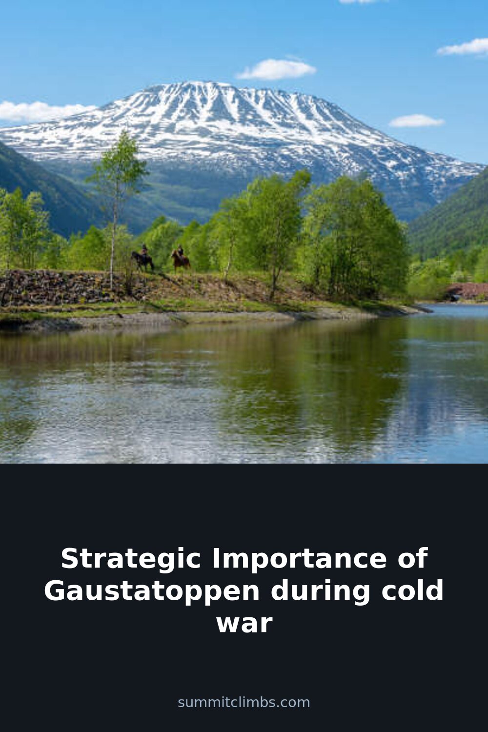
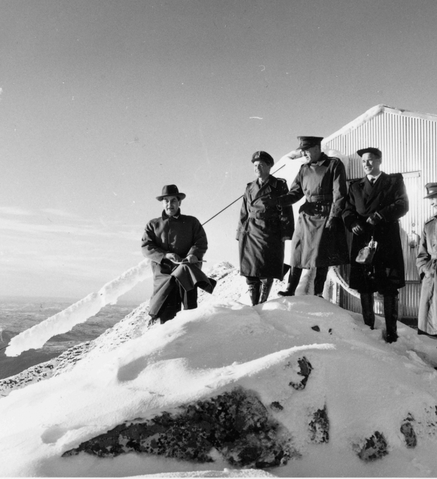
Gaustatoppen rises to 1,883 meters in Telemark, and from its top on a clear day, you can see a sixth of Norway. That view alone explains why NATO chose it. During the Cold War, the mountain’s height and central location made it an ideal spot for a radio relay station and listening post. The facility was financed largely by American military grants, and it operated in secrecy until the 1990s. For any mountaineer who values context, Gaustatoppen offers a rare blend of alpine challenge and Cold War history. The underground funicular, Gaustabanen, was originally conceived as a civilian tourism project in the early 1950s, but the Cold War repurposed it. Completed in 1959, it became the logistical artery for a secret NATO base inside the mountain. That’s not a detail you’ll find on every summit sign, but it’s the kind of backstory that makes a climb here different from a standard Norwegian peak.
The SummitClimbs Snapshot
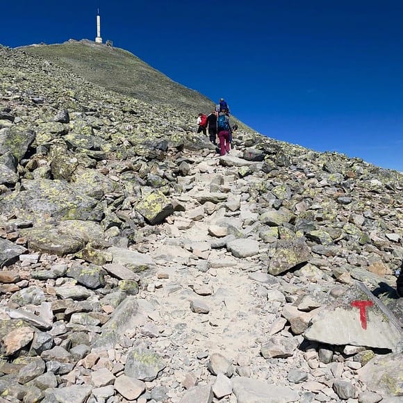
Gaustatoppen is not a technically difficult mountain, but it is serious. The weather can shift from calm to dangerous in under an hour. The summit is exposed, and the wind often makes the actual top feel smaller than the views suggest. The primary route from the parking area near Tuddal is well-marked but rocky, and in wet conditions, the slabs become slick. The Gaustabanen funicular now runs as a tourist attraction, offering a swift ascent through the mountain’s interior. If you take it, you’ll emerge near the summit in minutes, but you’ll skip the physical work and the gradual acclimatization to the ridge. For experienced hikers, the walk up is the better choice—it gives you time to read the mountain’s mood. The funicular is a practical option for families or those short on time, but it doesn’t replace the route knowledge you gain by moving over the ground yourself.
Route Reality and Local Conditions
The standard hiking route from Tuddal is about 8 kilometers round trip, with roughly 800 meters of elevation gain. The trail starts through birch forest, then opens onto rocky terrain as you approach the summit ridge. There are no technical sections, but the final push to the top involves scrambling over loose stone. In summer, the trail is usually clear, but snow can linger into late June. In winter, this is a full alpine environment requiring crampons, ice axe, and avalanche awareness. The Gaustabanen funicular operates seasonally, typically from late spring through early autumn, and it’s worth checking the schedule before you plan your trip. The summit itself has a small cabin and the old radio tower, which is still in use for civilian communications. The weather station on top is a reminder that this peak has always been about gathering information—military or meteorological.
For those who want to combine history with the hike, the Gaustabanen tour includes a guided visit to the former military rooms inside the mountain. The funicular ride itself is an experience: a 1,000-meter tunnel bored through rock, ending at a station just below the summit. The tour covers the Cold War period, and it’s a sobering contrast to the open landscape outside. If you’re climbing on your own, you can still see the antenna arrays and the reinforced structures near the top. They’re not hidden—just part of the summit’s current identity.
What to Watch For
First, the weather. Gaustatoppen creates its own microclimate, and the summit can be in cloud while the valley is clear. Wind speeds regularly exceed 20 meters per second on the ridge, and the temperature at the top is often 10 degrees colder than at the trailhead. Pack layers, a windproof shell, and a map even if you plan to use the funicular. Second, the rock. The summit area is covered in loose scree, and the footing requires attention, especially when descending. Third, the crowds. On a fine weekend, the trail from Tuddal can be busy, and the summit cabin can feel cramped. If you want solitude, start early—before 8 a.m.—or visit on a weekday. Fourth, the funicular. It’s a unique piece of engineering, but it’s not a secret anymore. Tickets sell out in peak season, so book ahead if you plan to use it. Finally, respect the military history. The installations are now civilian, but the site still carries a sense of operational seriousness. Don’t climb on the antenna structures or stray into marked-off areas.
The SummitClimbs Take
Gaustatoppen is a mountain that rewards preparation and curiosity. The hike itself is straightforward for anyone with moderate fitness and basic mountain sense, but the real value lies in understanding what you’re standing on. This is not just a peak with a view—it’s a former NATO listening post, a Cold War asset that was kept secret for decades. The Gaustabanen funicular, now open to tourists, was once a military supply line. That transition from secrecy to public access is part of what makes Gaustatoppen compelling. For the mountaineer who appreciates context, this is a summit that tells a story. For the casual hiker, it’s a rewarding day out with a fascinating footnote. Either way, come prepared, read the weather, and take a moment to think about what the mountain has seen. At SummitClimbs, we don’t just climb peaks—we try to understand them. Gaustatoppen is one of those places where the history is as solid as the rock.
Keep the Trails Alive
Summit Climbs is free — no ads, no paywalls, no sponsored fluff.
Every guide is written from real experience to help your next adventure.
If it helped, a small support means the world and keeps the site running.